The former military facilities can be visited
Military ObjectBerga/Elster
U-Verlagerung Schwalbe 5
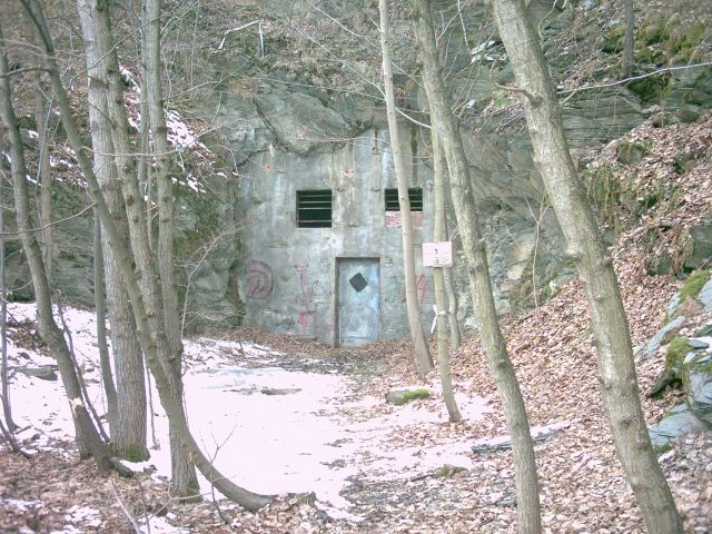
The U-Verlagerung Schwalbe 5 near Berga/Elster in Thuringia was a secret military construction project of World War II. As part of the Geilenberg Program, an underground factory for the production of synthetic aircraft fuel was to be built here to protect the war-critical fuel production from Allied air raids. The project was one of the largest of its kind and bears witness to the desperate efforts of the regime.
History+
After Allied air raids from 1944 onwards severely impacted German fuel production, the Geilenberg Program was launched to relocate war-critical industries underground. Decided on May 30, 1944, it was intended to secure the production of aircraft fuel. The U-Verlagerung Schwalbe 5, also known as Schwalbe V, was planned as a C-project (C1e) for BRABAG (Braunkohle-Benzin-AG) and was to cover a production area of 40,000 square meters. Originally intended for a slate mine in South Thuringia, the location was moved to Berga/Elster due to geological problems. Construction work began in October 1944 under the direction of SS-Obersturmführer Willy Hack. Funded by the SS, the facility was to consist of 18 parallel tunnels on the south side of the mountain, connected by cross tunnels. One of the cross tunnels was planned as a double-track railway tunnel, crossing the mountain and connecting to the Reichsbahn network. Forced laborers and prisoners from Buchenwald concentration camp were used for the construction work, for whom an external camp was set up in Berga. Despite the enormous effort and the construction of extensive infrastructure, including narrow-gauge tracks and barracks, the facility was not completed by the end of the war.
Location+
The U-Verlagerung Schwalbe 5 is located in Berga/Elster in the Greiz district of Thuringia, Germany, at an elevation of approx. 249 m above sea level.
On site+
The former military installations can only be viewed from the outside today.
Nearby+
- Schloss Berga (Castle), approx. 1.6 km away
- Herrenhaus Markersdorf (Mansion and Manor House), approx. 2.2 km away
- Rittergut Endschütz (Manor House), approx. 4.3 km away
- Gutshaus Wolfersdorf (Manor House), approx. 4.3 km away
Take Mobile History with you
You are reading this text for free. Premium adds what matters on the road: descriptions read aloud, sites found through your camera, whole regions taken offline.
- Every description, including the ~17,700 Premium sites
- Audio guide: have descriptions read to you on location
- AR finder: see sites through your camera, with distance and bearing
- Unlimited saved sites
14 days free, then from €2.99 a month. Cancel anytime.
Source: Wikipedia · Licence: CC BY-SA 4.0
This description draws on the facts documented in the linked Wikipedia article; Wikipedia content is licensed under CC BY-SA 4.0. Wording and editing: Mobile History.
Location: 50.7472, 12.1478