The Fort can be visited
FortressAalsmeerderbrug
Defence Line of Amsterdam-Fort Aalsmeer
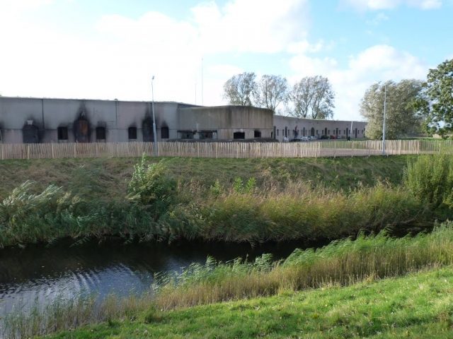
The UNESCO World Heritage Site known as the Defence Line of Amsterdam (in Dutch named Stelling van Amsterdam) is a 135 km long ring of fortifications around Amsterdam, consisting of 42 forts located between 10 to 15 kilometers the centre, and lowlands that can easily be flooded in time of war. The flooding was designed to give a depth of about 30 cm, insufficient for boats to traverse. Any buildings within 1 km of the line had to be made of wood, so that they could be burnt and the obstruction removed.
The Stelling van Amsterdam was constructed between 1880 and 1920. The invention of the aeroplane and tank made the forts obsolete almost as soon as they were finished. Many of the forts now are under the control of the town councils and the nature department, and may be visited. Monuments Day, on the second Saturday in September, is the ideal day to visit as entrance is free.
In the Fort near Aalsmeer you'll find the CRASH Luchtoorlog en Verzetmuseum (Aerial Warfare and Resistance Museum) ’40-’45, which is open on Saturdays. Children aged 0-6 years, donors and Veteran's pass holders can visit the museum for free.
Because it was used by the fire department to hold fire drills, part of the internal structure of the Fort near Aalsmeer is damaged. In 1996 the fort was beautifully restored on the outside, though. Remarkably, the gun turret buildings have remained intact. Most of the retractable turrets for this type of fort were removed during World War II by blowing up the small buildings that housed them. At this fort they were dismantled, though, leaving the buildings intact.
The Fort near Aalsmeer was intended to defend the ring dike (Haarlemmerringdijk), ring canal and the permanently dry strip of land. It also served as a defence for the Aalsmeerderweg and Aalsmeerdertocht roads. The fort was built in 1905 and outfitted with a double moat, because of the rising terrain on the edge of the polder that is difficult to flood. Northwest of the fort is a double lift-lock that served as an inlet for the inundation water of the ring canal into the Voorkanaal.
More information is available here.
Take Mobile History with you
You are reading this text for free. Premium adds what matters on the road: descriptions read aloud, sites found through your camera, whole regions taken offline.
- Every description, including the ~17,700 Premium sites
- Audio guide: have descriptions read to you on location
- AR finder: see sites through your camera, with distance and bearing
- Unlimited saved sites
14 days free, then from €2.99 a month. Cancel anytime.
Source: Wikipedia · Licence: CC BY-SA 4.0
This description draws on the facts documented in the linked Wikipedia article; Wikipedia content is licensed under CC BY-SA 4.0. Wording and editing: Mobile History.
Location: 52.2686, 4.7349