The City Wall can be visited
Town FortificationDrosendorf-Zissersdorf
Town Fortification Drosendorf
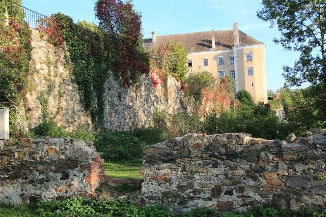
The Drosendorf city fortifications are the preserved city walls in the town of Drosendorf-Zissersdorf in the northern Waldviertel region of Lower Austria.
The 1.7 km long city wall encloses the entire old town of Drosendorf, which is located on a mountain spur in a loop of the Thaya river. The wall originally had two city gates, the Horner Tor and the Raabser Tor, of which the Raabser Tor is still preserved. The wall also incorporates the former castle, Drosendorf Castle. Today, a themed hiking trail runs around the city on the terraces of the walls.
A first city wall was already erected in the middle of the 13th century. With a wall thickness of 1.5 meters, it was about 8 meters high at the two gates. Between 1260 and 1300, two towers were built at the Horner Tor, which were also habitable. West of the Raabser Tor, a tower was soon built as well, which no longer exists today, as it was demolished in the 19th century. Only after that was the wall reinforced and brought into its present form. The wall became about 10 meters high and 1.9 meters thick. Construction work lasted until the first decades of the 15th century. Reasons for the reinforcement included the battles for the city in 1405 and the subsequent Hussite Wars. The round tower received walls 3 meters thick, so that artillery could also be repelled. A late Gothic zwinger fortification was built in front of the city wall almost all around the city, featuring numerous loopholes.
As artillery also became stronger in the 16th and 17th centuries, the zwingers had to be further reinforced. However, these outworks, built at the southeastern corner of the city wall, are largely no longer present today. A shooting range was established west of the castle in 1667.
Over time, the terraces with the zwingers were converted into gardens.
With this listed wall (BDA-ID:73607), Drosendorf is one of nine cities in Lower Austria where large parts are also preserved: Eggenburg, Hainburg an der Donau, Horn, Laa an der Thaya, Retz, Waidhofen an der Thaya, Weitra and Zwettl.
Take Mobile History with you
You are reading this text for free. Premium adds what matters on the road: descriptions read aloud, sites found through your camera, whole regions taken offline.
- Every description, including the ~17,700 Premium sites
- Audio guide: have descriptions read to you on location
- AR finder: see sites through your camera, with distance and bearing
- Unlimited saved sites
14 days free, then from €2.99 a month. Cancel anytime.
Source: Wikipedia · Licence: CC BY-SA 4.0 · Image: http://commons.wikimedia.org/wiki/File:Stadtmauer_Drosendorf_0841.jpg
This description draws on the facts documented in the linked Wikipedia article; Wikipedia content is licensed under CC BY-SA 4.0. Wording and editing: Mobile History.
Location: 48.8673, 15.6195