To be privately owned
CastleSigmundsherberg-Theras
Therasburg Castle
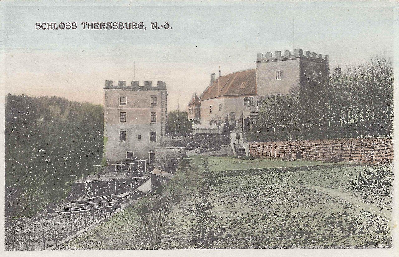
Therasburg Castle in Lower Austria is located west of the municipality of Pulkau in the cadastral community of Theras on a ridge above the Therasburger-Bach on the left side of the western Pulkau valley.
13th to 15th Century
The first known documentary mention is in 1327 as Ortlieb Zvendel von Teraczpurch. At the end of the 14th century, the castle fell directly to the Counts of Hardegg-Plain. It was the property of Berthold II, Burkhard III, and Johann II. In 1430, Jan von Fladnitz is attested as the castle warden for the Counts of Hardegg. The robber knight Kratzer used it from 1473 for raids, including on the nearby Rittsteig.
16th to 18th Century
In 1523, the castle was conquered by imperial forces. In 1574, the knight Jakob von Raming, a colonel, converted it into a Renaissance castle. In 1645, during the Thirty Years' War, it was destroyed by Swedish troops under General Lennart Count Torstensson. In 1674, Georg Julius Freiherr von Gilleis, also owner of the lordships of Missingdort and Kattau, came into possession of Therasburg.
19th to 20th Century
In 1823, Joseph Count von Gilleis is listed as the owner. The last of the Gilleis family, Julius von Gilleis, leased and later sold Therasburg to his son-in-law, Imperial Count Hermann von Attems, Baron von Heiligenkreuz. In 1842, the castle, which had been uninhabited for about 150 years, was restored. During the redesign, Hermann Eduard Count von Attems-Heiligenkreuz had the tower re-roofed and the 2nd floor of the main building removed. In 1893, it was restored by Maximilian Count von Attems-Gilleis, with a new bay window and a newly built second castle tower. On July 6, 1903, an excursion of the Lower Austrian Forestry Association took place at the forest house. During the Second World War, the holdings of the University Library of the University of Vienna, as well as the important reference works from the catalog room of the Austrian National Library – the remaining books distributed to eight other locations – were housed here, as well as in Horn Castle, Rosenburg Castle, and more than ten other places.
Description+
Therasburg consists of a stone bridge with remnants of the former drawbridge over a moat, a two-story main castle with a round-arched portal framed in white sandstone, and a separate tower. The building is a protected monument by decree of the Federal Monuments Office. The pointed-arch pedestrian access of the former gate entrance is preserved, and details indicate that a former drawbridge existed. Today, a two-arched bridge leads over the neck ditch, which was probably used as a former quarry for the castle. In the valley, it is surrounded by the Therasburger Bach, a direct tributary of the Pulkau.
Forestry+
Forest management was previously carried out using the selection system, in contrast to today's removal of areas damaged by bark beetles, deadwood, windbreaks, and snowbreaks. In 1897, the first forest management plan was implemented: the predominant tree species in the high forest was Scots pine, then spruce, with fir in clumps, and scattered oak, lime, and birch. In the coppice, it was oak, lime, birch, and goat willow. The forest soil is of medium quality, a weathering product of gneiss and glimmer schist. Large areas of former arable land were reforested around the turn of the century. There was a dedicated tree nursery for planting.
Surroundings+
Neighboring castles or palaces include the Nonneck ruin near Pulkau, Baroque Riegersburg Castle, Fronsburg Castle, and Schrattenthal Castle.
Take Mobile History with you
You are reading this text for free. Premium adds what matters on the road: descriptions read aloud, sites found through your camera, whole regions taken offline.
- Every description, including the ~17,700 Premium sites
- Audio guide: have descriptions read to you on location
- AR finder: see sites through your camera, with distance and bearing
- Unlimited saved sites
14 days free, then from €2.99 a month. Cancel anytime.
Source: Wikipedia · Licence: CC BY-SA 4.0 · Image: Nr. 23832 Seering, Wien XVI, Hasnerstr. 101, G. g. 1924 / Public domain via Wikimedia Commons
This description draws on the facts documented in the linked Wikipedia article; Wikipedia content is licensed under CC BY-SA 4.0. Wording and editing: Mobile History.
Location: 48.7155, 15.7757