Museum
CastleKaltennordheim
Kaltennordheim Castle
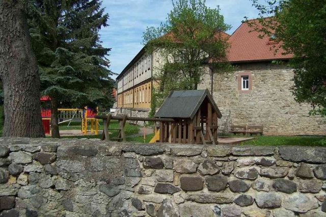
The upper Felda valley was dominated in the High Middle Ages by the Counts of Neidhartshausen, who were close relatives of the Henneberg Counts and had their ancestral castle in the neighboring town of Neidhartshausen. After the extinction of the Counts of Neidhartshausen, the fortified complex located on the Höhn near Klings and Fischbach was used as the administrative seat of the region. At this time, a castle complex also arose in Kaltennordheim, probably as the residence of a ministerialis in the service of the Hennebergs. The first documented mention of the castle dates to August 8, 1350. In this contract, the castle in Kaltennordheim was sold to the abbot of Fulda Monastery. However, as early as 1366, another document reports the purchase of the castle by a knight Henze von Allendorf - probably a former castellan of the Frankensteins in Bad Salzungen. Numerous documents from the following decades report on various alterations and extensions.
In 1525, the castle complex and its small garrison were no match for a siege by the rebellious peasants of the Felda valley during the German Peasants' War. The bailiff and castle captain Tham von Herda therefore abandoned the castle to its fate and fled to the fortress of Marsfeld near Meiningen. The castle was thus taken without a fight and plundered. In 1562, Kaltennordheim was granted town rights. The Felda valley was repeatedly traversed by marauding armies during the Thirty Years' War, and the town of Kaltennordheim was captured. The town fire of 1634 destroyed large parts of the town, and the castle was also severely damaged.
After the war, the ruins of the castle complex were leveled; by this time, it had little military significance.
A pen-and-ink drawing in a report issued in 1659 is the oldest known depiction of Merlinsburg. From 1752-54, the administrative building - also referred to as a palace - was rebuilt on the site of Merlinsburg. Existing parts of the surrounding wall were reused for this purpose. The striking courtyard gate with its clockwork was created as a representative entrance to the town.
Take Mobile History with you
You are reading this text for free. Premium adds what matters on the road: descriptions read aloud, sites found through your camera, whole regions taken offline.
- Every description, including the ~17,700 Premium sites
- Audio guide: have descriptions read to you on location
- AR finder: see sites through your camera, with distance and bearing
- Unlimited saved sites
14 days free, then from €2.99 a month. Cancel anytime.
Source: Wikipedia · Licence: CC BY-SA 4.0
This description draws on the facts documented in the linked Wikipedia article; Wikipedia content is licensed under CC BY-SA 4.0. Wording and editing: Mobile History.
Location: 50.6258, 10.1603