The remains of the Castle can be visited
RuinNassach
Wart Castle (Ruin)
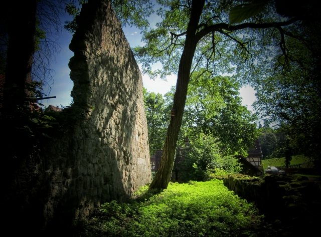
Today's Warthof Forester's House is located in rural solitude on the grounds of the ruined Wart Castle on the southern slope of the Winterlauter in the Löwenstein Mountains. Wart Castle was originally a medieval outpost or watchtower of the Margraves of Baden and is located southwest of Spiegelberg in the municipality of Aspach in the Rems-Murr district in Baden-Württemberg.
Wart Castle was built – depending on the source – at the beginning of the 12th century or around the year 1200 by the Margraves of Baden in the area between the larger castles of Löwenstein, Lichtenberg, and Reichenberg. The small ministerialis castle, along with the small chapel dedicated to Saint Lawrence, came into the possession of the Counts of Württemberg in 1297 through marriage to a Baden princess.
The castle was given as a fief by the Württembergers and pledged to Konrad von Stammheim around 1435. At this time, amber, gold, and silver were sought in a mine here. In 1509, Wart Castle was sold to Knight Eitelhans Nothaft and from him in 1524 to Trautwein Vaihinger von Schöntal. Rebellious peasants, whom Vaihinger had narrowly escaped in Weinsberg, plundered and set fire to the castle in the German Peasants' War of 1525. It was never rebuilt thereafter.
Further Use+
The ruin, fields, and forests came into the possession of Dietrich von Plieningen, who lived in Schaubeck Castle, through a donation in 1559. In 1650, the new lords erected the still-existing buildings on the castle grounds, which are now used as a forester's house, barn, and bakehouse. In 1862, the state of Württemberg bought the Wart estate and converted the farmhouse into a forest service station, which is now subordinate to the Backnang Forest Office.
Layout+
The rampart and moat are – with the exception of the northern area, which has been built over by a forest road – completely preserved. Significant remains of the northern curtain wall and the northern outer wall of the main building, made of sandstone ashlar, have been preserved.
Take Mobile History with you
You are reading this text for free. Premium adds what matters on the road: descriptions read aloud, sites found through your camera, whole regions taken offline.
- Every description, including the ~17,700 Premium sites
- Audio guide: have descriptions read to you on location
- AR finder: see sites through your camera, with distance and bearing
- Unlimited saved sites
14 days free, then from €2.99 a month. Cancel anytime.
Source: Wikipedia · Licence: CC BY-SA 4.0
This description draws on the facts documented in the linked Wikipedia article; Wikipedia content is licensed under CC BY-SA 4.0. Wording and editing: Mobile History.
Location: 49.0186, 9.4132