The remains of the Castle can be visited
CastleBretzwil
Ramstein Castle (Ruin)
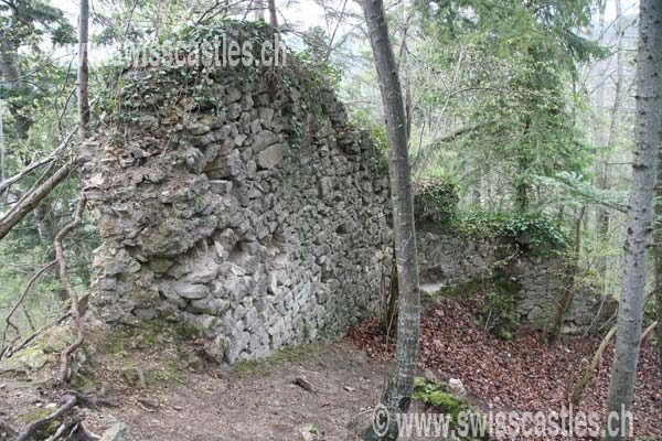
The Ramstein ruin is located about 700 meters south of the village of Bretzwil on a mighty rock outcrop, a northern spur of the Aletenchopf. In its immediate vicinity, 250 m east of the ruin, lies the Ramstein Castle Farm, which is still in operation today.
Only a few weathered remains of the once mighty castle are preserved. Illustrations of the castle date back to the 1 7th century. Many of the following details refer to these.
The former access was from the south via a zwinger (outer ward) built on the east side of the fortress. This is one of many examples that refutes the idea that zwinger were always designed so that the right side of a rider, unprotected by a shield, was exposed to the defender. Upon entering the castle, two gates had to be passed in the zwinger before the main gate was reached (behind the moat and drawbridge). The wall, equipped with a battlement, followed the contours of the terrain and enclosed the thus irregularly shaped castle complex.
In the inner courtyard, buildings were grouped against the curtain wall, and in the southern part of the castle, the upper castle rose on the clearly visible rock ridge. This consisted of a residential wing with a chapel, a cistern for rainwater, and the round main tower of the fortress. Because such a large complex could not be supplied solely from the cistern, there was also a fresh water supply likely from the higher-lying Aleten. This was constructed using wooden pipes (Teucheln).
Originally, the Ramstein family called themselves 'von Brislach'. Thus, a connection with the wooden & earth castle Moosgräben (east of Breitenbach) – the earliest form of castle building in this region – could be possible. Ramstein Castle must have existed as early as 1170, as the Ramsteiners participated in a feud against St. Alban's Monastery in that year. After the Ramstein family split in the 13th century, the rights were divided equally between the two main lines. In 1303, the fortress was destroyed by the Baselers because the Ramsteiners had captured a Basel citizen; a common means at the time to enforce legal claims or to participate in the business success of others.
After the reconstruction, the main Ramstein lines resided at Ramstein, Gilgenberg, and in Zwingen, where they were also affected by the Basel earthquake. The damage to Ramstein Castle cannot be precisely determined, but was probably minor, as there does not seem to have been a significant interruption in the use of the castle.
The Ramsteiners were quite expansive in the 14th and 15th centuries and tried to acquire further lordships, e.g., the Rifenstein. In 1459, one main line of the Ramsteiners died out, and so the fortress came back into undivided ownership. However, in 1518, Christoph von Ramstein presumably had to sell the now dilapidated castle with its associated rights to the city of Basel, probably for economic reasons. The Basel Vogt undertook a partial restoration of the complex. Parts of the increasingly dilapidated castle were inhabited until the 19th century. Then a rapid decay of the already heavily damaged building fabric set in; uninhabited parts had already been demolished earlier for safety reasons.
Take Mobile History with you
You are reading this text for free. Premium adds what matters on the road: descriptions read aloud, sites found through your camera, whole regions taken offline.
- Every description, including the ~17,700 Premium sites
- Audio guide: have descriptions read to you on location
- AR finder: see sites through your camera, with distance and bearing
- Unlimited saved sites
14 days free, then from €2.99 a month. Cancel anytime.
Source: Wikipedia · Licence: CC BY-SA 4.0
This description draws on the facts documented in the linked Wikipedia article; Wikipedia content is licensed under CC BY-SA 4.0. Wording and editing: Mobile History.
Location: 47.3903, 7.6542