The remains of the Castle can be visited
CastleEffretikon
Moosburg Castle (Ruin) (Effretikon)
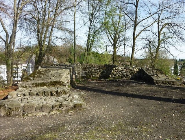
Moosburg is a castle ruin in the former hamlet of Moosburg in the south of Effretikon in the canton of Zurich. The castle was built around 1254 by Count Hartmann IV of Kyburg for his wife Margaretha of Savoy. After the death of the childless couple, the castle passed to the Habsburgs in 1273 and around 1300 as a fief to the Lords of Schlatt ZH.
In 1386 it was destroyed by the people of Zurich, and around 1400 Burkhard von Schlatt pledged Moosburg to his brother-in-law Johannes Schwend the Elder. During this time, it served as the administrative seat for several lower courts. Schwend's son of the same name was the first Zurich bailiff in the county of Kyburg. During his term of office from 1424 to 1437, he resided at Moosburg.
During the Old Zurich War, the castle was destroyed in May 1444 by the Central Swiss troops, and subsequently, the ruin served as a quarry. An engraving by David Herrliberger from 1745 shows that the tower and parts of the surrounding wall were still preserved.
The first excavations took place in 1896 by the Swiss Society for the Preservation of Historic Art Monuments. The yield was small; an iron helmet recovered from the well proved to be the most valuable find. In 1910, the Antiquarian Society in Zurich acquired the castle hill.
Extensive excavations took place in 1952 and 1953. Numerous shards of clay vessels, a crossbow bolt, and fragments of stove tiles from around 1400 were found. In 1955, Moosburg was acquired by the municipality of Illnau-Effretikon for 30,000 francs. The northern and western wall sections were conserved in 1970.
Construction+
The castle was situated on a moraine hill in a marshy plain, called Moos. The hill was accessible from the south via a bridge. The complex was surrounded by a wide and deep moat, which was reinforced in the southeast by a second moat. A strip of the reed bed has been preserved to the east of the castle hill.
The rectangular residential tower with a high entrance was about 13 meters long and 10.5 meters wide; the wall thickness was 2.2 meters. The living quarters were located on the upper floors. South of the tower was a residential building, and to the north were stables and utility buildings. A 1.2-meter thick curtain wall enclosed the buildings at a distance of about 5 meters.
Take Mobile History with you
You are reading this text for free. Premium adds what matters on the road: descriptions read aloud, sites found through your camera, whole regions taken offline.
- Every description, including the ~17,700 Premium sites
- Audio guide: have descriptions read to you on location
- AR finder: see sites through your camera, with distance and bearing
- Unlimited saved sites
14 days free, then from €2.99 a month. Cancel anytime.
Source: Wikipedia · Licence: CC BY-SA 4.0
This description draws on the facts documented in the linked Wikipedia article; Wikipedia content is licensed under CC BY-SA 4.0. Wording and editing: Mobile History.
Location: 47.4248, 8.6905