The remains of the Castle can be visited
RuinErpfingen
Hohenerpfingen Castle (Ruin)
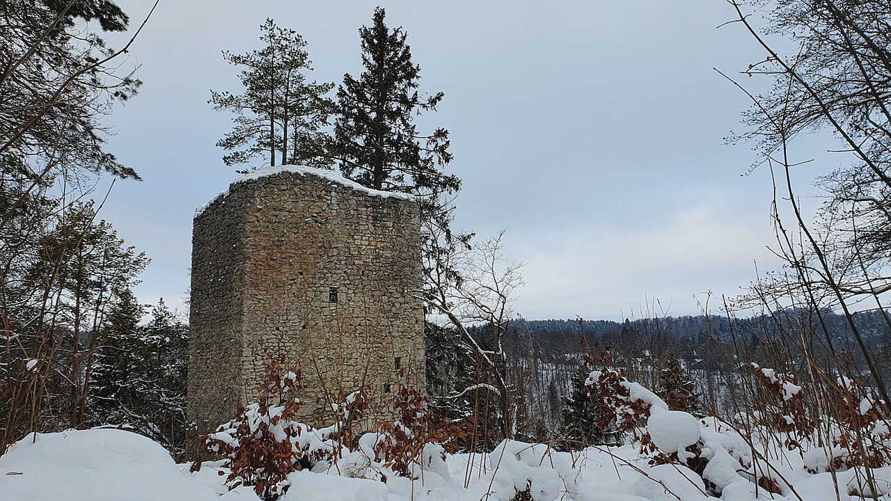
Hohenerpfingen Castle, also known as Schnatren, is the ruin of a high medieval hilltop castle that once rose above a valley corner of the Erpf. The castle ruin is located above Erpfingen, a district of the municipality of Sonnenbühl in the Reutlingen district in Baden-Württemberg, Germany. Of the castle, which was founded during the 12th century, only rock-cut moats and the towering shield-wall-like front wall of the core castle on a rock block remain today.
The site of the vanished castle is located approximately in the center of the Swabian Alb, on the slope of a meter-high mountain corner of the Kobel mountain in the forest section Schlosshalde. The castle site is about 75 meters above the Erpf valley, which comes from the east here and then turns south. To the north, northeast, and west, the terrain slopes steeply down to the valley, while in the southern direction, the Kobelberg rises gently to 808 m above sea level. The castle ruin is located about 815 meters west-southwest of the church in Erpfingen.
There are other former medieval castles nearby: In the village of Erpfingen itself, on the site of today's rectory, was the local castle of the Erpfingen family, of which nothing remains. Below the former Hohenerpfingen Castle, approximately in the area of today's festival hall, was the settlement of Niederhofen, which belonged to the castle.
About 1900 meters south are the ruins of Hölnstein and Aufhofen Castle, and to the northwest are the ruins of Hohenmelchingen and Salmendingen.
In the area of today's Erpfingen, there were formerly two settlements (Aufhofen and Niederhofen), each with its own local nobility and associated castles.
In 1304, a Christine von Erpfingen is mentioned in the documents. She was a nun in the Stetten monastery. This family, which called itself "Schenken von Erpfingen" around 1340, probably had its seat in the later built local castle. In the Middle Ages, ministeriales were often entrusted with the office of a cupbearer (Schenk) and thus rose to the service nobility. The remains of the local castle were demolished in 1864, the tower and the castle rock on which it stood were blown up. Today's rectory stands on this site.
About 500 meters west of the center of Erpfingen, approximately in the area of today's festival hall, was formerly the village of Niederhofen with its much older local nobility. This family resided in a manor house, the Stollenhof. Hohenerpfingen Castle was enthroned directly on a rock above it. The name "Hohenerpfingen" is controversial; Schmitt uses both names for the castle. Castle researcher Bizer exclusively uses the name "Schnatren" (colloquially "Schnatrete"). The name could be derived from the old term "Snade," which formerly referred to a border, as the castle was indeed located at the outermost edge of a small dominion, at whose outer borders far more influential families were able to establish themselves and made an expansion of the castle lords' own dominion in this direction impossible. Very little is known about the early history of Hohenerpfingen Castle; according to dated ceramic finds, it was built in the second half of the 12th century.
Later, the "Lords of Salmendingen" were owners and residents of the Stollenhof and at that time also resided at Hohenerpfingen Castle. A marriage proved to be the downfall of the family and, consequently, of both Hohenerpfingen and Salmendingen Castles: Agate von Salmendingen (possibly a sister of the castle lord residing in Erpfingen) married "Burkhard von Mansberg" (lower nobility, ministerialis from Dettingen unter Teck) around 1350, who through her became owner of Salmendingen Castle. During its heyday, the castle lord had the Erpf stream dammed at the height of today's municipal boundary to Stetten, creating a considerable fish pond. The remains of the mighty weir mound are still visible today.
Since the Mansperger family, related by marriage, sided with the Dukes of Teck, who were rivals of the House of Württemberg, conflicts with the rising Counts of Württemberg repeatedly arose in later history. Württemberg's Eberhard II at that time strongly directed his policy against the imperial cities that stood in the way of Württemberg's further expansion. Numerous costly battles and expensive fights took place in the region, which probably also demanded tribute from the Erpfingen castle lord. For in 1358, Heinz von Salmendingen sold "all the goods and rights that I had in Erpfingen in the village, be it wood, field, pasture or Zwing, visited and unvisited or however it is named, without the castle, which is called Schnatren, and the wood that is located below it" to Friz Remp von Pfullingen (ministerialis at Remppenburg near Pfullingen). Only the castle itself remained in the possession of the Erpfingen castle lord.
The Dukes of Teck were even forced to sell their ancestral lands around Teck Castle to the House of Württemberg in 1386. The impending decline of the house also had serious consequences for the loyal Mansberger family and the families connected to them: in 1385, Hohenerpfingen Castle was referred to as a "Burgstall," meaning a castle in decline, and sold to the Pfullingen family. Salmendingen Castle was even abandoned in the 14th century after its destruction (!) and was left to decay from 1386 onwards.
In the Cities' War (1387-1389) against the Württembergers, the Mansberger family put everything on one card, officially appearing as adversaries of the Württembergers in 1388 and entering the service of the imperial cities. Burkart von Mansberg was captain of the Esslingen forces and attacked Württemberg's Grötzingen. There were many dead, and the Esslingen forces, under Mansberg's leadership, took 56 prisoners. It is to be assumed that the Erpfingen castle lords also sought protection and refuge in the imperial cities.
The Württembergers won the war. The former Salmendingen territory (Ringingen, Salmendingen, Melchingen, and Erpfingen) was assigned to the princely house of Fürstenberg and placed under the administration of the House of Werdenberg (Ministerialis Jehle zu Trochtelfingen). The Mansberger family and their allied families, as was customary at the time, had to serve as servants or administrators of the victorious Counts of Württemberg after the war. According to tradition, the former castle lords of Hohenerpfingen, the family of "Heinz von Salmendingen," are said to have been resettled as Württemberg servants in surrounding villages, outside their former Salmendingen dominion.
In 1394, the children of Agate von Salmendingen and "Burkhard von Mansberg" renounced all their claims to Salmendingen Castle and village.
The House of Württemberg acquired the ruins of Hohenerpfingen from Caspar Remp von Pfullingen in 1487. On a map in a sea book created under Duke Friedrich of Württemberg, Hohenerpfingen is again referred to as "Schnatren, also an old Burgstall." The fish pond still seemed to exist at that time.
Around 1800, the castle ruin was owned by the municipality of Erpfingen. This in turn sold "the ancient tower in the local municipal forest Schlosshalde, along with the immediate surroundings of 1 to 2 Morgn Platz..." to Count Wilhelm von Württemberg. He planned a romantic knight's castle there for one of his sons. In 1868, the municipality of Erpfingen unsuccessfully tried to reacquire the castle ruin. In 1985, restoration measures were carried out on the castle ruin under the architect Rudolf Brändle.
According to an unrefuted theory, the "Heinz" family, still rooted in Sonnenbühl-Willmandingen today, is said to have descended from the former family of "Heinz von Salmendingen."
Take Mobile History with you
You are reading this text for free. Premium adds what matters on the road: descriptions read aloud, sites found through your camera, whole regions taken offline.
- Every description, including the ~17,700 Premium sites
- Audio guide: have descriptions read to you on location
- AR finder: see sites through your camera, with distance and bearing
- Unlimited saved sites
14 days free, then from €2.99 a month. Cancel anytime.
Source: Wikipedia · Licence: CC BY-SA 4.0 · Image: Oliver L. 74 / CC BY-SA 4.0 via Wikimedia Commons
This description draws on the facts documented in the linked Wikipedia article; Wikipedia content is licensed under CC BY-SA 4.0. Wording and editing: Mobile History.
Location: 48.3480, 9.1862