The remains of the Castle can be visited
RuinGehülz
Heunischen Castle (Ruin)
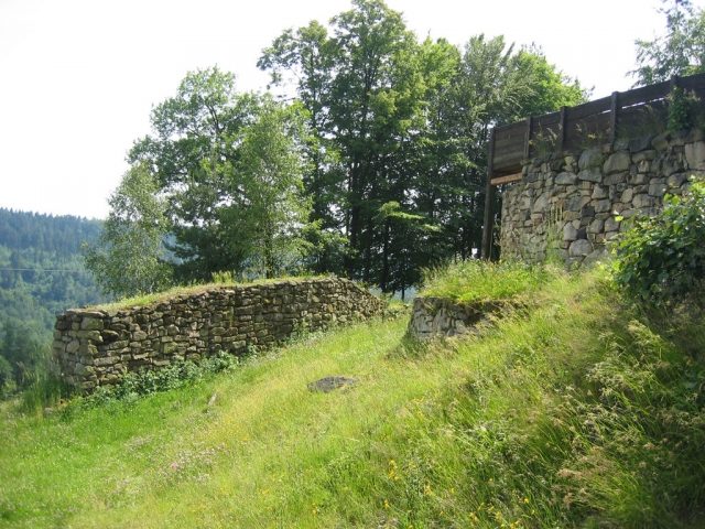
The Heunischenburg is the oldest scientifically investigated stone fortification in Europe north of the Alps.
The complex is located on a 486-meter-high mountain spur of the Wolfsberg, between the Kronach district of Gehülz and the village of Burgstall (municipality of Mitwitz). The fortification presumably served to monitor a copper and tin trade route into the Fichtelgebirge.
While a mighty, 110-meter-long rampart wall secured the vulnerable eastern flank of the former military camp, the steeply sloping sides of the mountain spur offered natural protection on the other sides, which was also reinforced by a wooden palisade.
A typical construction of a pincer gate and a sally port reveals late Mycenaean influence, suggesting contacts with Mediterranean civilization.
The mighty, yet small-scale fortification and the many weapons found clearly distinguish the Heunischenburg from the large central settlements of the late Bronze Age.
Name+
Two interpretations are discussed:
- The term "Heunen" can be understood as something originating from a grey, legendary antiquity.
- The root word "Heunen" (giants) could be related to gigantic builders of the defensive structure, who sprang from the imagination of medieval people.
Excavations revealed three settlement periods:
- In the first period, the Heunischenburg consisted of a timber-earth fortification.
- In the second period, defense was ensured by a sandstone wall, which probably burned down in battle.
- The third period was the expansion of the Heunischenburg into a strong defensive complex.
The northeastern flank was protected by a 2.6 m wide, 3.5 m high, and 110 m long wall made of sandstone. In front of this was a 3.5 m wide berm and a shallow material ditch.
The wall of the inner gate flank in the gate area continued only as a single shell.
The outer gate flank, built on the slope, was 2 m wide and continued as a 55 m long wooden palisade. This probably enclosed the entire complex.
The inner gate flank had a 1 m wide gate at its beginning with a projecting wooden tower.
Excavation
The archaeological dating was based on numerous bronze finds (about 70 percent weapons). These included needles, rings, razors, decorative discs, embossed sheet metal fragments, fragments of swords, spearheads, and arrowheads. Since many arrowheads were found that had been used unburred, it is assumed that at least temporarily there was an extremely high demand for ammunition in the garrison. A helmet from the Urnfield period was found in nearby Thonberg.
Reconstruction
In 1986 and 2000, based on secured findings, a section of the wall from the last fortification phase was reconstructed, with a projecting berm, the gate with its wooden tower, and the gate passage extending far into the interior.
Take Mobile History with you
You are reading this text for free. Premium adds what matters on the road: descriptions read aloud, sites found through your camera, whole regions taken offline.
- Every description, including the ~17,700 Premium sites
- Audio guide: have descriptions read to you on location
- AR finder: see sites through your camera, with distance and bearing
- Unlimited saved sites
14 days free, then from €2.99 a month. Cancel anytime.
Source: Wikipedia · Licence: CC BY-SA 4.0
This description draws on the facts documented in the linked Wikipedia article; Wikipedia content is licensed under CC BY-SA 4.0. Wording and editing: Mobile History.
Location: 50.2426, 11.2655