The remains of the Castle can be visited
CastleWaltensburg
Grünenfels Castle (Ruin) (Waltensburg)
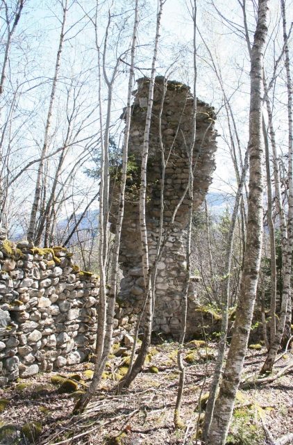
The ruin of Grünenfels Castle lies north of the municipality of Waltensburg, between the ravines of the Flem and Ladral streams.
Grünenfels was one of the originally four castles in Waltensburg, alongside Jörgenberg, Kropfenstein, and Vogelberg Castle.
The ruin is located at the eastern end of a ridge, separated from it by a neck ditch. Since the ruin is completely overgrown, it is difficult to find in the forest if one does not know its location. It can be reached from Waltensburg church via a dirt track in ten minutes.
The name appears in the 13th century in several spellings: for example, in 1257 as Gruoninvels, in 1278 as Gruenenvels, and in 1289 as Gruonvels. It refers to the green Bündner slate used in its construction. It has not been clarified whether the building material came from the immediate vicinity of the castle. In this case, the main building would also have stood on green rock.
Until 1960, only a few wall remnants and the tooth of a wall corner were visible from the castle. In 1961, a looting excavation by youths forced the Rhaetian Museum to conduct an emergency excavation, during which the floor plan in the area of the main castle was uncovered and some small finds were secured. However, because the excavation remained unfinished, the building history of the castle is still not fully clarified. The complex is now heavily overgrown with small trees and bushes, and the masonry is accordingly in an extremely poor condition and close to complete decay.
A threshold from the mighty gate in the south is still preserved. The main part of the complex consisted of a square tower in the western part with a side length of almost 9 meters and 1.8 meter thick walls. The residential and economic buildings were located in the eastern part. The wall remnants date from different construction phases. The preserved wall tooth at the southeast corner suggests a building of at least three stories. The elongated, artificially leveled plateau of the outer bailey in the east, separated by a ditch, shows no traces of walls.
Excavated objects such as stove tiles and various iron objects show that the castle was built in the late 12th century and was inhabited until the late 14th century. The ring wall is likely to date from the founding period. In the first half of the 13th century, the complex was supplemented by a strong main tower.
Grünenfels Castle was the ancestral seat of the family of the same name, who probably belonged to the free nobility but never managed to rise into the small class of the noble free of the Vorderrheintal. In 1257, a Conrad von Grünenfels is first mentioned in a document. The next generation, represented by the brothers Albert (1278–1321) and Heinrich (1278–1295) von Grünenfels, was already the last of the family.
Albert's daughter Margarethe married Heinrich von Montalt, who thus came into possession of Grünenfels Castle. Heinrich II von Montalt handed over Grünenfels, along with other property, to his brother-in-law Ulrich Walter von Belmont in 1357 to settle a dispute with him. In 1358, he received it back as a fief.
After the death of Heinrich II von Montalt, his rights to Grünenfels passed to a cousin, who sold them in 1378, along with other property, to Ulrich Brun von Rhäzüns. The estates and rights of Grünenfels henceforth belonged to the Rhäzüns lordship of Jörgenberg. After this transfer, Grünenfels is likely to have been abandoned.
Take Mobile History with you
You are reading this text for free. Premium adds what matters on the road: descriptions read aloud, sites found through your camera, whole regions taken offline.
- Every description, including the ~17,700 Premium sites
- Audio guide: have descriptions read to you on location
- AR finder: see sites through your camera, with distance and bearing
- Unlimited saved sites
14 days free, then from €2.99 a month. Cancel anytime.
Source: Wikipedia · Licence: CC BY-SA 4.0
This description draws on the facts documented in the linked Wikipedia article; Wikipedia content is licensed under CC BY-SA 4.0. Wording and editing: Mobile History.
Location: 46.7794, 9.1203