The City Wall can be visited
Town FortificationRostock
Town Fortification Rostock
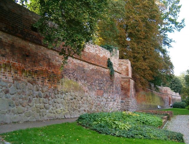
The Rostock city fortifications, an impressive testament to medieval defensive architecture, once encircled the Hanseatic city of Rostock and protected it for centuries. It stands as an outstanding example of the development of urban defense systems in Northern Germany and still offers diverse insights into the city's past today.
History+
The origins of Rostock's fortifications date back to the 12th century, initially protecting only the area around St. Peter's Church and the Old Market. With the unification of Rostock's three constituent towns in 1265, a common, approximately three-kilometer-long city wall was built, featuring over 20 gates, including land and sea gates. In the 14th and 15th centuries, many of these gates were expanded into mighty gate towers. During the Thirty Years' War (1618–1648), a comprehensive expansion into a fortress took place under Wallenstein. In the 19th century, as the city grew beyond its walls, the fortifications were de-fortified and partially demolished. Destruction during World War II and subsequent demolitions further reduced the existing structures. Nevertheless, three land gates (Steintor, Kuhtor, Kröpeliner Tor), one sea gate (Mönchentor), a wall tower (Lagebuschturm), and large sections of the city wall, totaling about 1300 meters, as well as parts of the fortress rampart, remain preserved. Some sections of the fortifications were reconstructed in the 1930s.
Location+
The Rostock city fortifications are located in the city of Rostock, within the urban area of Rostock, in the federal state of Mecklenburg-Vorpommern, Germany. They are situated at an elevation of approximately 15 meters above sea level.
On site+
Today, visitors can explore large parts of the historic city fortifications, including the preserved gates, towers, and wall sections.
Nearby+
- Kloster zum Heiligen Kreuz (sacred building), approx. 0.1 km away
- Rostocker Stadtbefestigung-Kröpeliner Tor (city fortification), approx. 0.1 km away
- Herzogliches Palais (residence), approx. 0.3 km away
- Marienkirche (sacred building), approx. 0.6 km away
Take Mobile History with you
You are reading this text for free. Premium adds what matters on the road: descriptions read aloud, sites found through your camera, whole regions taken offline.
- Every description, including the ~17,700 Premium sites
- Audio guide: have descriptions read to you on location
- AR finder: see sites through your camera, with distance and bearing
- Unlimited saved sites
14 days free, then from €2.99 a month. Cancel anytime.
Source: Wikipedia · Licence: CC BY-SA 4.0 · Image: https://commons.wikimedia.org/wiki/File:Stadtmauer_Klostergarten.jpg
This description draws on the facts documented in the linked Wikipedia article; Wikipedia content is licensed under CC BY-SA 4.0. Wording and editing: Mobile History.
Location: 54.0876, 12.1306