The Roman Fort can be visited
Ancient BuildingBo'ness
Roman Fort Kinneil
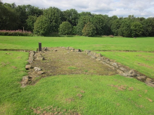
This small fortlet was discovered in 1978 and excavated during 1980/81. A single coin has been recovered from the site, a sestertius of Trajan (Imp. A.D.98-117) found in topsoil above the drain on the west road. Other finds included a cache of well-preserved shoes from a 10 ft. (3 m) deep pit in the north-west corner. There are no inscriptions on stone recorded in the R.I.B. for the Kinneil fortlet.
The fortlet measures about 70 ft. north-south by around 60 ft. east-west (c.21.5 x 18.5 m), covering an area of just one-tenth of an acre (c.0.04 ha). The fort is aligned to the north with the Antonine Wall forming its northern defences, the remaining S, E and W sides being defended by a 10 ft. (3 m) wide rampart built of turf with an earth fill upon a base of cobble-stones and fronted by two small ditches. There were 10 ft. (3 m) wide gateways set in the centre of both the north and the south sides, the one to the north formed by two rows of five post-holes and opening out onto the unbroken ditch of the Wall, that on the south furnished with three post-holes on each side and approached by a causeway across the shallow defensive ditches. The postholes of two small rectangular buildings, each about 11½ by 13¼ ft. (3.5 x 4 m) and aligned north-south, were uncovered in the north-east and south-west corners.
There are three temporary marching camps nearby at Inveravon to the south-west (at NS9579 & NS9679).
Take Mobile History with you
You are reading this text for free. Premium adds what matters on the road: descriptions read aloud, sites found through your camera, whole regions taken offline.
- Every description, including the ~17,700 Premium sites
- Audio guide: have descriptions read to you on location
- AR finder: see sites through your camera, with distance and bearing
- Unlimited saved sites
14 days free, then from €2.99 a month. Cancel anytime.
Source: Wikipedia · Licence: CC BY-SA 4.0
This description draws on the facts documented in the linked Wikipedia article; Wikipedia content is licensed under CC BY-SA 4.0. Wording and editing: Mobile History.
Location: 56.0054, -3.6415