The Roman Castle can be visited
Ancient BuildingHuppert
Roman Castle Dörsterberg (Huppert)
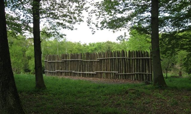
The small fort on the Dörsterberg (often abbreviated to Kleinkastell Dörsterberg, also listed as Watchtower Wp 2/43 in the documentation of the Imperial Limes Commission), is a former Roman border fort of the Upper Germanic Limes, which has held UNESCO World Heritage status since 2005. The former military camp is now an archaeological monument located between the municipalities of Laufenselden and Huppert, both districts of the municipality of Heidenrod in the Rheingau-Taunus-Kreis, Hesse.
Location+
The archaeological monument, still visible in the terrain, is located below the summit on the south-sloping hillside of the Dörsterberg. From here, there was excellent line of sight, extending west to Watchtower Wp 2/41 and east/south-southeast to the small forts "Auf dem Pohl bei Kemel".
Research History+
The former Roman fortification was discovered in 1897 by Ludwig Pallat. In 1902, archaeological excavations began by the Imperial Limes Commission, but these were not completed as planned due to the unexpected death of Felix Hettner.
Findings+
In the course of the archaeological investigations, several construction phases could be differentiated.
The older of the two structures was built in wood and stone. It was surrounded by a double V-shaped ditch. The outer ditch was still preserved in the natural ground with a width of 1.45 m and a depth of 1.10 m. The inner one reached a depth of 1.80 m with a width of 2.25 m. The fort area enclosed by the ditches had the shape of a slightly irregular quadrangle with rounded corners and side lengths of approximately 23 m by 25 m. The inner area was thus about 575 m². Immediately (without a significant berm) on the inside of the inner ditch, traces of palisades and walls of the former enclosure were found. Whether these were two distinct construction phases, an earthwork with a wooden palisade and a stone-walled fort, could not be reliably determined with the excavation techniques of the time, but is considered probable. Behind this enclosure was an earth rampart, already heavily eroded at the time of the excavations, which had originally supported the rampart walk.
Within the older complex, shifted slightly to the south and rotated from the axis cross of the older camp, was a rectangular wall with rounded corners. The side lengths were 18 m by 15 m. Traces of a stone building and some post holes within the wall suggest former construction on the inner surface.
The Limes palisade passes the camp in a northerly direction, about 20 m from the outer edge of the outer ditch.
Nothing is known about the garrison of the fort. It was probably a vexillatio of a larger auxiliary troop or a legion. The fort met its end in connection with the abandonment of the Limes around the years 259/260.
Take Mobile History with you
You are reading this text for free. Premium adds what matters on the road: descriptions read aloud, sites found through your camera, whole regions taken offline.
- Every description, including the ~17,700 Premium sites
- Audio guide: have descriptions read to you on location
- AR finder: see sites through your camera, with distance and bearing
- Unlimited saved sites
14 days free, then from €2.99 a month. Cancel anytime.
Source: Wikipedia · Licence: CC BY-SA 4.0
This description draws on the facts documented in the linked Wikipedia article; Wikipedia content is licensed under CC BY-SA 4.0. Wording and editing: Mobile History.
Location: 50.1975, 7.9950