The Roman Castle can be visited
Ancient BuildingPförring
Roman Castle CELEVSVM (Celeusum)
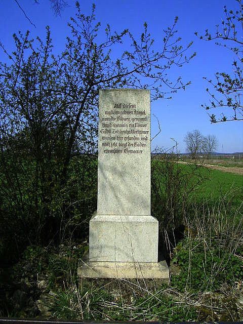
The former Roman fort of Pförring (ancient name Castrum Celeusum) is now located about 900 m north in the fields in front of the Bavarian market town of Pförring in the district of Eichstätt and was built as the site of a mounted Roman unit to secure the Danube crossing. This crossing is mentioned in the Nibelungenlied as "ze Vergen".
The former fort site, also known as Biburg, lies on an almost square small plateau at the northeastern edge of the Kelsbach valley and stands out clearly in the landscape with its embankments. Planted trees and bushes also indicate the former ramparts. Next to the Porta Praetoria, the northwest gate of this camp, there is now an old beer cellar surrounded by trees. To the south lies the Danube lowlands, to the west flows the Kelsbach, whose name still recalls the ancient site. From the northwest gate, the Roman military could overlook the long-distance road leading to Fort Eining.
The Pförring area was already settled in prehistoric times. A continuity up to Roman times has not yet been established in the area of the military camp and its village.
Research History+
Already in the 16th century, scholars became aware of the Biburg. Johannes Aventinus (1477–1534) was already familiar with a dedication stone, now preserved in Munich, which, in addition to the Celtic horse goddess Epona, also names the Campestres, who were regarded by Roman legionaries as goddesses of the parade ground.
In 1838, it was reported that the gate entrances, ramparts, and ditches were still clearly visible and many coins, especially from the reign of Emperor Hadrian (117–138), had been found. Even before and also later, amateurs dug in the area, such as the innkeeper Ignaz Busch, who discovered the building inscription at the Porta Decumana in 1843. However, more precise excavations only took place through the Reichs-Limes-Kommission (RLK). The fort site, approximately 194 × 201 meters in size, was oriented with its broad side to the northwest in the direction of the ancient road. The excavators found a continuous double V-shaped ditch, interrupted at the four gates, surveyed the location of the four corner towers and gates, and then examined the Principia (headquarters building) more closely. Overall, however, even the Principia, apart from the flag sanctuary (Sacellum or Aedes), remained largely unexplored.
The discovery of clay sling bullets provides insight into the additional armament of the troops.
The fort site is still used for agriculture today. No excavations have taken place within its interior since 1893. The formerly restored remains of the east gate and the northern corner tower have again largely decayed. However, the complex and the Vicus are repeatedly successfully surveyed from the air. In 2005/06, magnetic field measurements were carried out on parts of the fort, and in 2007, these investigations were extended to the northeast of the Vicus. The entire undeveloped area of the fort and camp village is now threatened by intensive agriculture, erosion, and ongoing illicit excavations.
In 2009, excavations by the Ingolstadt company Pro Arch, under the direction of Dr. Jan Weinig, took place in the area of the northeast gate. Following these excavations, it is planned to open up the entire area to visitors. For this purpose, parking spaces and paths will be created. As little as possible of the ancient building remains is to be made visible; the actual main attraction was planned by an architect and consists of a steel framework that will be erected at the northeast entrance of the fort and imitates a Roman gate.
Construction History+
The garrison was probably consistently the Ala I Flavia singularium civium Romanorum pia fidelis, mentioned in the military diploma issued in Weißenburg on June 30, 107. It is believed to have built the first timber-and-earth fort at the beginning of the 2nd century. Various finds, especially Terra Sigillata, could be dated to this period.
Based on the building inscription found in a field in 1843, it is known that the Ala rebuilt the fort in stone in 141. The Reichs-Limes-Kommission was able to determine that the limestone defensive wall was a good 1 m thick and that there was a wooden rampart walk inside. Intermediate towers were not discovered. The builders had carved the round arches of the four double gates from volcanic tuff stone. From the remains of the gates themselves, it could be seen that they had consisted of 16 cm thick iron-clad planks.
Ramparts
The embankment, still up to five meters high today, was specially prepared for the complex. Terracing has been found in the southwest and southeast of the fort, possibly related to preparatory leveling of the fort area. Such foundation measures could be proven in the southwest of the area. Three V-shaped ditches were found in front of the embankment. Until 2007, these could only be analyzed in more detail on the northeast side. Both the outer and inner ditches stop in front of the northeast gate, while the middle one was only crossed by a wooden bridge. During the excavations undertaken at the northeast gate in 2009, the remains of a stone tablet were uncovered, among other things. As was customary at this time, the four corners of the approximately 194 × 201 m (= 3.9 ha) rectangular stone defensive wall are rounded (playing card shape). A watchtower stood in each. Intermediate towers are unknown. All four gates of the camp were equipped with double passages and flanked by two towers each.
Internal Buildings
The Principia, the headquarters building, was oriented to the northwest. Here was the praetorial front, which pointed towards the most probable direction of attack of a potential enemy. The structure of the Principia largely followed the usual scheme. A large multi-purpose hall was located in front of the actual building, standing centrally over the Via principalis. This road connected the southwest and northeast gates in Pförring. Behind it, service and administrative rooms were grouped around an open courtyard. Centrally, in the rear part of the Principia, was the flag sanctuary and the troop treasury. This sanctuary in Celeusum was equipped with a semicircular apse. The design of sanctuaries with apses had become common in Roman forts, especially in the Germanic area, since the middle of the 2nd century. The apse of Pförring does not bulge out of the building, as often observed on the Upper Germanic-Raetian Limes, but is integrated into the complex invisibly to the outside observer, similar to what can still be seen today at the small fort "In der Harlach". Hair and garment remains of a large bronze statue, dated to between 150/250 AD, were found in the headquarters building.
To the west, next to the Principia, lay a building stretching along its flank, which first became known through aerial photographs. In its nature, it resembles the granaries (Horreum) common in this area. To the east, magnetometry prospecting revealed a large, complex building that could belong to the remains of the commander's house (Praetorium). Many details are also known today about the elongated barracks and stables, built in plastered half-timbered construction. In the front camp (Praetentura), the camp area located between the praetorial front and the Principia, there were two troop quarters each along the Via Praetoria, the main road leading from the headquarters building to the northwest gate, with their gables facing the road. The northern two were designed as double barracks for horse and rider, followed by two barracks of normal size. The same picture was presented in the Retentura, the rear camp area south of the headquarters building. Towards the defensive wall, now flanking the Via decumana there with its narrow side, two double barracks had been erected. In front of them, the magnetometer could clearly identify at least one single barrack east of the Via decumana. The pit-like anomalies recognizable to the west in the measurement also make a troop quarter probable there, which would correspond to the standard scheme of contemporary forts. Further elongated barracks for the troops were made in the area of the outer Latera, the central part of the camp, where the Principia, the Horreum, and the Praetorium were also located. Here, the quarters were built with their long sides on the Via sagularis, the camp ring road, surrounding the interior of the fort. There are also other structures there, which must belong to workshops (Fabrica) and other buildings required in a barracks.
It is assumed that Emperor Caracalla visited the camp in 213. This is indicated by the remains of a limestone slab, on which originally 9 cm high gilded bronze sheet letters were attached. This slab is considered part of an honorary inscription for the emperor. Such inscriptions with inlaid letters have also been discovered at many other fort sites on the Limes, for example in Pfunz and at Schirenhof.
The end of the camp is seen in the Alamannic storm of 233. An unfortunately incomplete hoard ends with a coin from the reign of Emperor Severus Alexander (222–235), but the end could also have come much later.
Together with the fort, a Roman road was built around 80 AD, which can still be traced very well today west of Pförring to Kösching.
Building Inscription
The building inscription from the year 141 reads:
Imp(eratori) Caesari divi
Hadriani fil(io) divi Tr(aiani)
nepo(ti) Tito Ael(io) Hadri
ano Antonino Aug(usto)
Pio pontif(ici) maximo
p(atri) p(atriae) consul(i) III tribun(icia)
pot(estate) IIII ala I singular(ium)
p(ia) f(idelis) c(ivium) R(omanorum)
The original of this inscription is now located at the Sebastian's Chapel in Pförring.
Troops and Officers+
The Ala I Flavia singularium civium Romanorum pia fidelis was a cavalry unit of about 500 men. There are also legacies concerning officers. In 1903, during the renovation of the parish church, a tomb inscription, held by two naked winged boys and still measuring 1.22 × 0.5 meters today, was found. It once belonged to a corresponding monument and is now, like the building inscription, at the Sebastian's Chapel in Pförring. It names the Decurio (cavalry captain) Primus Saturninus and his wife, Julia Victorina. This Decurio had once served in Fort Weißenburg and probably retired in Pförring at the end of the 2nd century AD.
Prim(us) Saturninus
ex dec(urione) al(ae) Auri(anae) m(issus) h(onesta) m(issione)
Iul(iae) Victorinae uxo(ri)
Prim(ae) Saturninae / [ ---
Translation:
Primus Saturninus, former honorably discharged cavalry captain of the Ala Auriana, to his wife Julia Victorina ...
The name of a commander (Praefectus Alae) of the Ala I Flavia singularium civium Romanorum pia fidelis, Aelius Bassianus, was also preserved on an altar for the Campestres and the Celtic horse goddess Epona.
Campest(ribus) et
Eponae ala I
sing(ularium) p(ia) f(idelis) c(ivium) R(omanorum) qui prae(est)
Ael(ius) Bassianus
praef(ectus) v(otum) s(olvit) l(ibens) l(aetus) m(erito)
Translation:
To the goddesses of the parade ground and Epona, the First Ala Flavia Singularium of Roman citizens, reliable and faithful, commanded by Aelius Bassianus, gladly, joyfully, and deservedly fulfilled its vow.
Fort Bath+
The bath, located 150 meters southeast of the fort and decorated with frescoes, was already destroyed in 1823.
Vicus, Temples and Graves+
Like the fort site, the area of the camp village remains undeveloped to this day. Following older excavations, especially during the construction of the bypass road in 1978, a part of the camp village (vicus) located west of the fort, with its various stone buildings, was investigated. In summary, it was found that the large and representative buildings discovered significantly exceed the Eining findings in number and extent, which suggests the size and importance of Pförring. The ongoing investigations at the fort also identified many building remains in the southeast and northeast of the fort.
During previous excavations, silver tableware was recovered from a temple, and a pottery was uncovered in the east in the early 1980s. Nearby, early historical graves could be observed. In addition to the building inscription in the churchyard wall of Pförring, two tombstones and a stone relief depicting Romulus and Remus are known. All three pieces are now located at the Sebaldus Chapel near the parish church. The remaining finds were transferred to the Archaeological State Collection in Munich and to the Museum of Prehistory and Early History in Eichstätt. In the northeast, it was found that the Vicus maintains an undeveloped distance of about 60 meters from the fort. Only behind a road encircling the camp, running parallel to the defensive wall from southeast to northwest, does the village begin at this point. At the north corner of the outer fort ditch, this route turns southwest and then leads past the northwest front of the fort to the military road to Kösching. To the south, it runs past the fort bath.
Due to continuous regular agricultural use, cremation graves, which are located, among other places, to the north of the fort, have repeatedly been plowed up in the past. Approximately 300 meters northeast of the military complex, already outside the Vicus, another cemetery belonging to Pförring was located on both sides of the ancient route leading from the fort to Castra Abusina (Eining). The grave finds made at this site suggest a high standard of living for the Vicus inhabitants. Among the urns found were so-called face urns. In 1979, the foundation of a grave tower was identified near the Roman road with the help of aerial archaeology. Grave towers are also considered monuments of a family's social standing and wealth.
Prehistoric Fortifications+
Approximately 400 m northwest of the fort, on a loess slope gently sloping to the west, lay a prehistoric fortification approximately 60 × 60 m in size, forming a shifted square and surrounded by three parallel ditches. Based on aerial photographs, it is assumed that they were designed as V-shaped ditches. The orientation of these approach obstacles is approximately north-south and southeast-northwest. Research suggests that the work probably dates from the Hallstatt period and belonged to the type of fortified manor houses of that time. In Roman times, two stone buildings were constructed one behind the other on the completely leveled ground of a ditch corner, one of which has almost square forms, while the other has an elongated form with at least two clearly separated rooms. These buildings probably still belonged to the Vicus of the fort. Furrows, which also disturb the prehistoric complex at the edge, could indicate clay pits of a nearby Roman brickworks or pottery.
With the geomagnetic prospecting of the fort's interior in 2005/2006, prehistoric structures also became clear in the area of the Retentura. The measurement image clearly showed an oval complex, approximately 40 x 80 meters in size, surrounded by a double ditch, oriented with its long side almost exactly in a north-south direction and approaching the Roman flag sanctuary closely to the north. Fassbinder assumes a late Neolithic or Altheim culture earthwork. At a later time, the earthwork had either already disappeared or was leveled, and a courtyard surrounded by a double ditch was built at this location, which easily encompassed the old complex in its extent. Only the northern part of this was known in 2007. This extends in a northwesterly direction with a rounded ditch tip that reaches under the inner courtyard of the Principia and could, like its northern counterpart 400 m away, also form a shifted rectangular shape as a whole. On its north-northwesterly oriented flank, within the enclosure, there is a much smaller ditch system, which Fassbinder considered a possible Hallstatt period manor house. This rectangular complex, also surrounded by a double ditch, is oriented with its long side almost exactly in a north-south direction. To the west, it takes over the ditch of the large complex and overlaps the oval of the oldest settlement site by up to half to the east. To what extent this small complex and the larger ditch system are contemporary or successive could only be clarified by an excavation below the Roman horizon.
Post-Fort Use+
During the Migration Period, Pförring was used for isolated burials. In 1977, three post-Roman burials were found in the oldest Vicus area, consisting of a man with very few, simple grave goods and a pit two meters away containing two horse skeletons. However, a new settlement of the site could not be inferred from these individual finds. The well-preserved ancient remains of the fort can be attributed to its renewed use as a defensive structure in the Middle Ages. This shows that at least the wall ring of the camp must have been in a more or less good condition after the fall of the Limes. In the Middle Ages, an 8 × 12 meter rectangular chapel with a semicircular apse was built inside the former multi-purpose hall connected to the Principia. It was located, with the apse oriented to the east, in the area of the former northeastern end of the building and shows no regard for the ancient building structures.
Pförring in the Nibelungenlied+
The Nibelungenlied mentions the Danube crossing at the fort as "ze Vergen" (at the ferrymen). According to this, the Burgundian princes Giselher and Gunther, who accompany their sister Kriemhild on her bridal journey to King Etzel, pass the old fort site via the Roman road, which was still clearly visible during the Middle Ages due to its continued use, to the river.
Important Military Finds+
From a hoard found in the camp village, deposited in the uncertain period of the first half of the 3rd century AD, come two larger bronze fragments of breastplates, fragments of other breastplates, and other equipment parts of cavalry parade armor. The hoard also included the still fragmentary remains of two bronze mask helmets of "oriental" type. These finds are now in the Archaeological State Collection in Munich.
In 1990, the upper part of a one-piece bronze greave, created in the 2nd/3rd century and depicting the goddess of victory Victoria and the god of war Mars, was found in the fort. This piece is also in Munich.
Take Mobile History with you
You are reading this text for free. Premium adds what matters on the road: descriptions read aloud, sites found through your camera, whole regions taken offline.
- Every description, including the ~17,700 Premium sites
- Audio guide: have descriptions read to you on location
- AR finder: see sites through your camera, with distance and bearing
- Unlimited saved sites
14 days free, then from €2.99 a month. Cancel anytime.
Source: Wikipedia · Licence: CC BY-SA 4.0
This description draws on the facts documented in the linked Wikipedia article; Wikipedia content is licensed under CC BY-SA 4.0. Wording and editing: Mobile History.
Location: 48.8185, 11.6818