The remains of the roman Watchtower can be visited
Ancient BuildingNassau-Pohl
Roman Watchtower 2/25
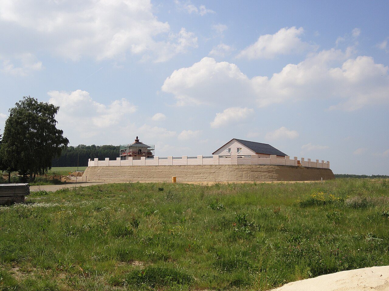
The Upper Germanic-Rhaetian Limes, with a length of 550 km, from Eining near Regensburg to Rheinbrohl on the Rhine, is the largest archaeological monument in Germany and has been recognized by UNESCO as a World Heritage Site. Limes (Latin: border path/wall) refers to the border fortifications of the Roman Empire, which were erected towards the end of the 1st century AD.
This border was monitored by more than 900 towers, which were built in timber construction during the initial phase, starting around 80 AD. Stone towers followed, which were plastered from 150 AD onwards. Excavations have shown that the white plaster often had incised joints, which were painted in terracotta. This created the impression of beautiful ashlar masonry.
Watchtower 2/25+
A tower site still visible in the terrain today, with two wooden towers and one stone tower.
The square stone tower had a side length of approximately 5.50 m and a wall thickness of only 80 cm. At a distance of about two meters, the tower was surrounded by a shallow ditch, also almost square, which in places was filled with large quantities of burnt debris, wattle and daub, and slate slabs. In the western corner of the tower was a pit 75 cm wide, 1.40 m long, and 2.40 m deep, of unknown purpose. It was filled with the building rubble of the tower. Immediately in front of the stone tower site, the Limes wall and large ditch were interrupted. The foundations of the stone tower are preserved.
The two wooden towers were located on a circular platform with a diameter of approximately 8.80 m. The posts of the inner tower indicated a square ground plan with a side length of 2.30 m, while those of the outer tower suggested a side length of around five meters. The wooden towers were surrounded by ring ditches. The inner ring ditch had a diameter of about 11.40 m (sole-to-sole), the outer one 19.5 m. Both ditches had an interruption on the northeast side. The inner ditch was partly filled with large quantities of burnt debris, ceramic shards, and charcoal, and the ground was reddishly vitrified by heat exposure.
The Limes palisade passed the wooden tower site at a distance of about 15 m. It cuts through the southwestern slope of a prehistoric burial mound.
Take Mobile History with you
You are reading this text for free. Premium adds what matters on the road: descriptions read aloud, sites found through your camera, whole regions taken offline.
- Every description, including the ~17,700 Premium sites
- Audio guide: have descriptions read to you on location
- AR finder: see sites through your camera, with distance and bearing
- Unlimited saved sites
14 days free, then from €2.99 a month. Cancel anytime.
Source: Wikipedia · Licence: CC BY-SA 4.0 · Image: Frank Winkelmann / CC BY 3.0 via Wikimedia Commons
This description draws on the facts documented in the linked Wikipedia article; Wikipedia content is licensed under CC BY-SA 4.0. Wording and editing: Mobile History.
Location: 50.2440, 7.8762