The remains of the roman Villa can be visited
Ancient BuildingBad Rappenau-Zimmerhof
Roman Villa Zimmerhof
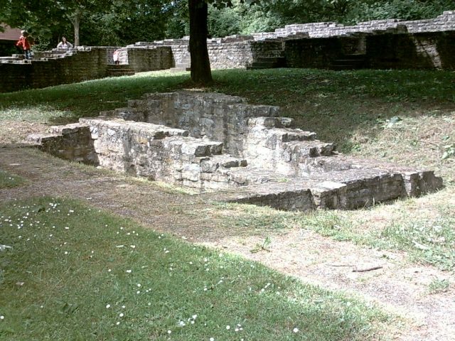
The Villa rustica at Römersee near Zimmerhof, a district of Bad Rappenau in the Heilbronn district in northern Baden-Württemberg, was a manor (a villa rustica) during the Roman Empire. Remains of the foundation walls of the main building of the manor are preserved and have been partially supplemented.
The manor was probably built in the second half of the second or at the beginning of the third century AD. The remains of its main building were discovered in 1971 and completely excavated in 1972 by the State Monuments Office of Baden-Württemberg, as they were to fall victim to land consolidation. After the excavation, the city of Bad Rappenau and the Sinsheim Land Consolidation Office decided to restore the building instead. The site has since been freely accessible to visitors.
Layout+
The main building of the manor, built on the southern slope of the Jungfrauenberg, was rectangularly arranged around an inner courtyard. An inner colonnade (peristyle) was found in the western part of the courtyard. A cellar with an earthen floor was located in the northwest, and a small rectangular annex with a hearth and drain channel, which served as a kitchen, adjoined it to the east. A second annex in the southeast housed the firing room of an underfloor heating system (hypocaust). Further simply equipped utility rooms were located in the east and north wings of the building as well as in the southeast of the inner courtyard. In the south wing, which is below the level of the north wing due to the slope, there were representative, colorfully plastered living rooms, including a heated hall measuring 16 × 4 m. Simpler living rooms without heating and with simpler plaster were found in the west and north wings.
The north and west wings, especially the cellar in the northwest, were best preserved. They were therefore restored and provided with new screed floors. The south and east wings of the building as well as the annexes in the east and southeast have been indicated by stone slabs since the restoration.
Take Mobile History with you
You are reading this text for free. Premium adds what matters on the road: descriptions read aloud, sites found through your camera, whole regions taken offline.
- Every description, including the ~17,700 Premium sites
- Audio guide: have descriptions read to you on location
- AR finder: see sites through your camera, with distance and bearing
- Unlimited saved sites
14 days free, then from €2.99 a month. Cancel anytime.
Source: Wikipedia · Licence: CC BY-SA 4.0 · Image: https://commons.wikimedia.org/wiki/File:Siegelsbach2.jpg?uselang=en
This description draws on the facts documented in the linked Wikipedia article; Wikipedia content is licensed under CC BY-SA 4.0. Wording and editing: Mobile History.
Location: 49.2559, 9.1132