To be privately owned
ManorWeißdorf-Bug
Bug Manor
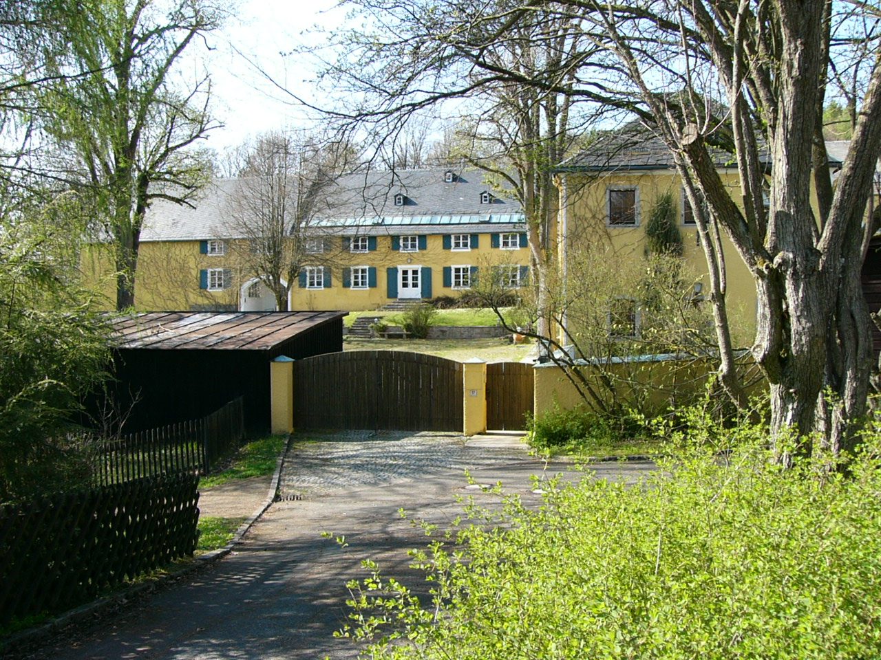
The Bug Manor was a manor in Bug, today part of the municipality of Weißdorf. Following earlier buildings, a castle was built at the end of the 18th century, which still exists as an extensive estate.
The development of fortified residences in Bug began with a motte-and-bailey castle on the Bugberg and another complex in the village, which, due to barely visible traces in the terrain, is to be described as a burgstall. Both complexes are difficult to date; according to the settlement history of the region, they date from the 12th century or a later century. Such mottes had a protective and representative character for the clearing lords; in the case of Bug, it can be assumed that they secured the medieval long-distance road via Weißdorf and Schwarzenbach an der Saale and a ford on the Saale towards Wulmersreuth. In the village, a stone Kemenate (stone house) was mentioned several times in 1502.
At the beginning of the 14th century, the von Sparneck family appeared as owners in Bug. The manorial seat consisted of a stately farm and a mill. Unlike the current location of the estate, the residence was on the opposite side of the road, where a playground was built in 1980, and the last traces of the terrain disappeared. Only in the northeast has a section of a moat been preserved. Norbert Goßler assumes that the manorial seat was destroyed during the Hussite invasion in 1430 or in the Franconian War in 1523, as existing buildings later remained uninhabited, and Bug was certainly not spared from the devastations in the surrounding area. A mystery is connected with the castle Weytzndarff (see Wandereisen woodcuts from 1523) - many reasons speak for the assumption of equating it with the manor in Bug, but there is no certainty about this. The manor was rebuilt at the end of the 16th century with stones from the old complex and Uprode Castle and was soon after connected with a sheep farm.
The Knights of Sparneck in the Weißdorf line are still traceable until 1590 with extensive possessions in Bug. Since they repeatedly pledged the manor and their possessions to the Burgraves of Nuremberg or the later Margraves, other persons were also briefly enfeoffed with possessions in Bug. In 1590, the related von Tettau family inherited the property, including the neighboring Uprode Castle, and held it until the middle of the 17th century. Other prominent families, such as the von Lindenfels and the von Schönburg-Waldenburg, followed.
In 1783, according to the report of Helfrecht Johann Georg August Friedrich von Lindenfels, the remains of the manor were demolished, and a castle complex was built in the immediate vicinity. The chemist Johann Wolfgang Döbereiner grew up there as the son of the estate manager. At the beginning of the 19th century, the castle was already described as dilapidated. It was divided into two halves, and the owners changed. The complex passed to the von Schönburg family in 1848 and fell victim to a fire in 1884. However, the sum of the fire insurance was not used for reconstruction but for the construction of the Fahrenbühl hunting lodge. Nevertheless, the south wing and a later structurally altered gatehouse remained. In one of the outbuildings of the castle estate, a cross-ribbed vault over arches was uncovered only in 1961 and dated to the 16th century. The business of Otto Stritzel experienced a boom during the Second World War. He combined the sheep farm with a weaving mill and produced high-quality textiles with up to 300 employees. In 1972, the business had to close for economic reasons.
Lothar Ulsamer, who bought the manor in 1998, is the 40th owner since the estate's existence. He has settled there to re-establish the sheep farm on the Bugberg.
Take Mobile History with you
You are reading this text for free. Premium adds what matters on the road: descriptions read aloud, sites found through your camera, whole regions taken offline.
- Every description, including the ~17,700 Premium sites
- Audio guide: have descriptions read to you on location
- AR finder: see sites through your camera, with distance and bearing
- Unlimited saved sites
14 days free, then from €2.99 a month. Cancel anytime.
Source: Wikipedia · Licence: CC BY-SA 4.0 · Image: PeterBraun74 / CC BY-SA 3.0 via Wikimedia Commons
This description draws on the facts documented in the linked Wikipedia article; Wikipedia content is licensed under CC BY-SA 4.0. Wording and editing: Mobile History.
Location: 50.1957, 11.8472