The Ruin can be visited
MonasteryOs
Lyse Abbey (Ruin)
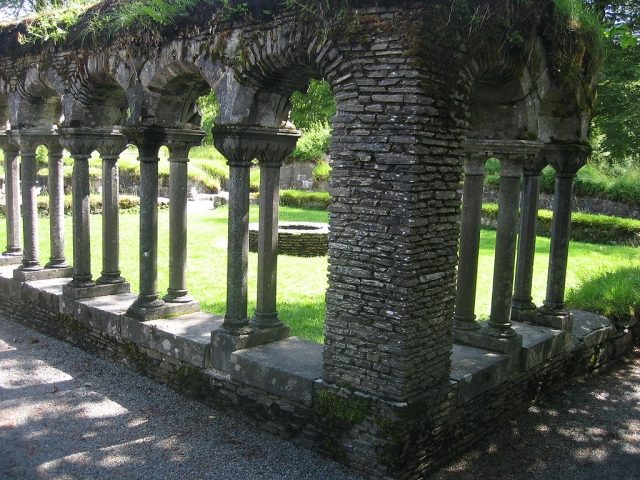
The ruins of Lysekloster, a former Cistercian monastery, bear witness to a significant ecclesiastical past in Norway. Located in the municipality of Os in Hordaland, the monastery once served as an important spiritual and economic center in the Westland region.
History+
Lysekloster was founded in 1146, made possible by a donation from Bishop Sigurd of Bergen. It was settled by monks from the English Fountains Abbey, which itself originated from the primary abbey of Clairvaux. Under its first abbot, Ranulf of York, Lysekloster developed into one of Norway's wealthiest monasteries, owning extensive land, including 200 farms. In 1207, Lysekloster itself founded Tautra Abbey. With the Reformation, the monastery was secularized by the Danish King Christian III in 1536/37. Over the following two centuries, the complex was demolished and used as a quarry, for example, for the construction of the Rosenkrantz Tower in Bergen. In the 19th century, excavations took place (1822, 1838, 1888/1889), and around 1920, initial restoration work was carried out. Today, the ruin is protected as a national monument.
Location+
The ruins of Lysekloster are situated in the municipality of Os in the Hordaland district, within the Westland (Vestlandet) region of Norway, at an elevation of approximately 44 meters above sea level.
On site+
The ruins of Lysekloster are now accessible to visitors and can be explored. They are preserved as a protected national monument.
Nearby+
- Gamlehaugen Castle (castle), approx. 13.4 km away
- Fredriksberg Fortress (fortress), approx. 19.6 km away
- Bergenhus Fortress (fortress), approx. 19.8 km away
- Sverresborg Fortress (fortress), approx. 19.9 km away
Take Mobile History with you
You are reading this text for free. Premium adds what matters on the road: descriptions read aloud, sites found through your camera, whole regions taken offline.
- Every description, including the ~17,700 Premium sites
- Audio guide: have descriptions read to you on location
- AR finder: see sites through your camera, with distance and bearing
- Unlimited saved sites
14 days free, then from €2.99 a month. Cancel anytime.
Source: Wikipedia · Licence: CC BY-SA 4.0
This description draws on the facts documented in the linked Wikipedia article; Wikipedia content is licensed under CC BY-SA 4.0. Wording and editing: Mobile History.
Location: 60.2275, 5.4055