The Ruin can be visited
MonasteryLevanger
Munkeby Abbey (Ruin)
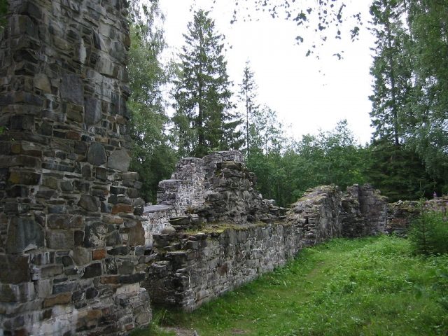
The Munkeby Abbey Ruin, once the northernmost Cistercian monastery in the world, is located in the Norwegian municipality of Levanger. This historic site bears witness to a eventful past and is today a freely accessible testament to medieval sacred architecture.
History+
The founding of Munkeby Abbey is dated to around 1150, but no later than 1180, when it was first mentioned in documents. It is believed that it may have been a foundation of Lysekloster. As early as 1207, it was relocated to the nearby Tautra Abbey, after which Munkeby continued as a grange. An attempt to revive the monastery around 1470 failed. In 1567, the complex was destroyed by fire. The church, dedicated to Saint Brettiva, served as a parish church until 1589. Excavations were carried out in 1910, and since 1967, the ruin has been owned by the Norwegian Society for the Preservation of Ancient Monuments. Notably, a new Cistercian monastery was founded nearby in 2007, the first in 500 years.
Location+
The Munkeby Abbey Ruin is situated near Okkenhaug in the municipality of Levanger, in the Nord-Trøndelag district of the Trøndelag region, Norway, at an elevation of approximately 120 meters above sea level.
On site+
Today, the outer walls of the church are preserved up to a height of one to two meters, revealing a nave and a choir with side chapels on both sides. The ruin, which also served as a quarry in its history, is accessible to visitors and can be explored.
Nearby+
- Steinvikholmen Fortress (Fortress), approx. 33.5 km away
- Tautra Abbey Ruin (Sacred Building), approx. 39.7 km away
- Leangen Gård (Mansion and Estate), approx. 54.2 km away
- Munkholmen Fortress (Fortress), approx. 57.1 km away
Take Mobile History with you
You are reading this text for free. Premium adds what matters on the road: descriptions read aloud, sites found through your camera, whole regions taken offline.
- Every description, including the ~17,700 Premium sites
- Audio guide: have descriptions read to you on location
- AR finder: see sites through your camera, with distance and bearing
- Unlimited saved sites
14 days free, then from €2.99 a month. Cancel anytime.
Source: Wikipedia · Licence: CC BY-SA 4.0
This description draws on the facts documented in the linked Wikipedia article; Wikipedia content is licensed under CC BY-SA 4.0. Wording and editing: Mobile History.
Location: 63.7167, 11.3667