To be privately owned
Hospice
MonasteryPolling
Polling Abbey
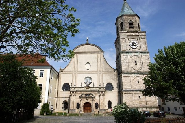
Kloster Polling, a former Benedictine and later Augustinian Canons monastery, is located in the Upper Bavarian district of Weilheim-Schongau and boasts a long and eventful history. For centuries, it served as a significant religious and cultural center in the region.
History+
The foundation of Kloster Polling is dated to around 750, with the actual founders likely stemming from a local noble family. Following expropriations and damage during the Hungarian invasions, the monastery was reoccupied by regular canons from 1010, who adopted the Augustinian Rule in the early 12th century. A new church was consecrated in 1160, after King Henry IV had ceded the monastery to the Bishop of Brixen in 1065. In the 13th century, Polling developed into a pilgrimage site. After a fire, the church was rebuilt in the Gothic style in the early 15th century. Under Provost Johannes Zinngießer (1499–1523), further buildings such as the prefecture, refectory, and library were erected. In the 18th century, the reconstruction of the monastery began, and the monastic school was expanded, teaching according to the Jesuit curriculum. The monastery significantly contributed to the financing of the Wieskirche. Prominent scholars like Eusebius Amort and Franz Töpsl worked here. Töpsl, provost from 1744 to 1796, had the monastic library rebuilt, doubled its book collection, and established scientific cabinets and an observatory. In 1803, the monastery was secularized, and a large part of its extensive library was dispersed or lost.
Location+
The former Kloster Polling is situated in Polling in the Upper Bavarian district of Weilheim-Schongau at an elevation of approximately 571 meters above sea level.
On site+
After its secularization in 1803, the monastic estate was acquired by Johann Rudolf Meyer in 1804 and temporarily served as the center of a Protestant Swiss community. Today, the preserved buildings and structures bear witness to the monastery's former significance.
Nearby+
- Former monastery inn (approx. 70 m away)
- West wing of the monastery (approx. 150 m away)
- Former monastery beer cellar (approx. 1338 m away)
- Formerly tithe barn of Ettal Monastery, after 1855 district office building (approx. 3234 m away)
Take Mobile History with you
You are reading this text for free. Premium adds what matters on the road: descriptions read aloud, sites found through your camera, whole regions taken offline.
- Every description, including the ~17,700 Premium sites
- Audio guide: have descriptions read to you on location
- AR finder: see sites through your camera, with distance and bearing
- Unlimited saved sites
14 days free, then from €2.99 a month. Cancel anytime.
Source: Wikipedia · Licence: CC BY-SA 4.0
This description draws on the facts documented in the linked Wikipedia article; Wikipedia content is licensed under CC BY-SA 4.0. Wording and editing: Mobile History.
Location: 47.8117, 11.1317