To be privately owned
ManorHückelhoven
Mahrhof Manor (Hückelhoven)
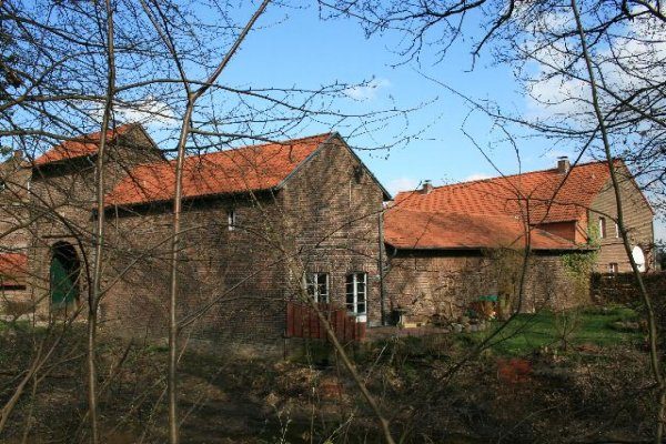
The Mahrhof is an old manor farm near Ratheim in the area of the city of Hückelhoven. The word Mahr in its name, as a variant of Maar, refers to a damp, wet place.
The simple farm, formerly surrounded by moats, plays an important role in the city's history, as the owners had family ties to the Olmissen family called Mülstroe (at Haus Hall in Ratheim and Haus Hückelhoven).
The A 46 motorway runs directly past the Mahrhof, separating the farm from Haus Hall and Ratheim to the north. To the east lies Millich, and to the south runs the Rur river. The Mahrweg, named after the farm, leads from Ratheim past Haus Hall to the Mahrhof and further to Millich.
Description+
The four-winged brick complex was built in its core in 1578. A vaulted cellar and the gatehouse with its two stories probably also date from the same period. The still preserved roller holes of the gate bear witness to the formerly existing drawbridge, just as a loophole on the left side of the gate tells of the former defensiveness of the manor. Above its round-arched passage, there was formerly an alliance coat of arms. One half of it showed the Mülstroe coat of arms, which is the basis of today's Hückelhoven city coat of arms. The armorial stone had once been stolen but has since been recovered.
After the Mahrhof was destroyed by fire in 1883, today's two-story building, which formerly served as a residence, is said to have been built on the old foundations.
Originally, the Mahrhof belonged to the neighboring Haus Hall. Heinrich von Olmissen, called Mülstroe, divided this property by will. His son Gotthard von Olmissen, called Mülstroe, received the Mahrhof and built the manor house in 1578. The family belonged to the Reformed faith but possessed a hereditary burial right for the Catholic church in Ratheim. While his grandson was still buried in this church in 1683, this was legally denied to his widow. Through marriage, the farm first came to Rütger von Beeck zu Beeck, then via Johann Meinard von Goltstein and Franz Freiherr von Pelden called Cloudt, finally to the von Zandt family in 1831. Today the farm is leased. Part of the land was bought by the Sophia-Jacoba mine to compensate farmers.
Take Mobile History with you
You are reading this text for free. Premium adds what matters on the road: descriptions read aloud, sites found through your camera, whole regions taken offline.
- Every description, including the ~17,700 Premium sites
- Audio guide: have descriptions read to you on location
- AR finder: see sites through your camera, with distance and bearing
- Unlimited saved sites
14 days free, then from €2.99 a month. Cancel anytime.
Source: Wikipedia · Licence: CC BY-SA 4.0 · Image: Käthe und Bernd Limburg, www.limburg-bernd.de / CC BY-SA 3.0 de via Wikimedia Commons
This description draws on the facts documented in the linked Wikipedia article; Wikipedia content is licensed under CC BY-SA 4.0. Wording and editing: Mobile History.
Location: 51.0572, 6.1886