The Fort can be visited
FortressTiconderoga
Fort Ticonderoga
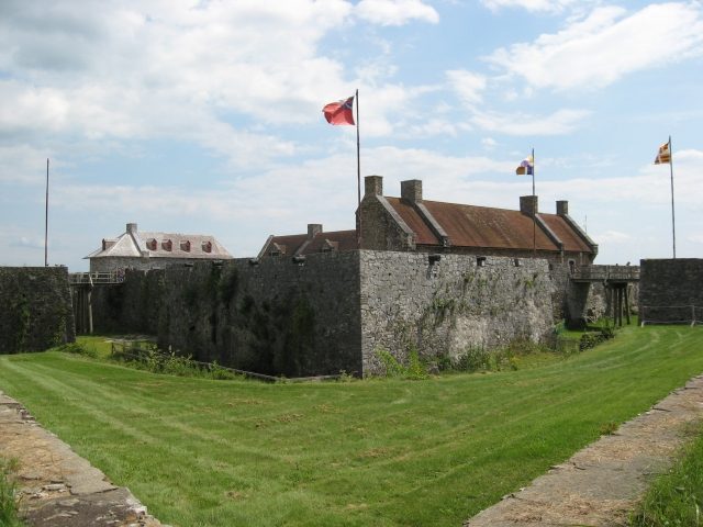
Fort Ticonderoga is a significant 18th-century fortification, strategically located at a narrow point on Lake Champlain in the U.S. state of New York. From this position, the passage to the northern end of Lake George could be controlled. The name “Ticonderoga” originates from the Iroquois language, meaning “place between two waters,” which highlights the geographical importance of the site.
History+
The fortress was constructed in 1755 by French troops and initially named Fort Carillon. It dominated crucial trade routes between the British-controlled Hudson Valley and the French-dominated Saint Lawrence River. Within just 20 years, Fort Ticonderoga was the scene of four battles and sieges. One of the bloodiest was the Battle of Ticonderoga in 1758 during the French and Indian War, when a British army launched a costly frontal assault on the French defenders. The following year, in 1759, the French abandoned the fort in the face of superior British forces, blew it up, and retreated. The British repaired the damage and occupied the site. During the American Revolutionary War, American troops surprisingly captured the fort in 1775, seizing important supplies. In 1777, the British managed to reoccupy the fort by placing artillery on the commanding Mount Defiance. After the British defeat at the Battle of Saratoga, the fort lost its significance and was abandoned in 1780.
Location+
Fort Ticonderoga is situated in Ticonderoga, Essex County, New York, USA, at an elevation of approximately 54 meters above sea level.
On site+
Today, Fort Ticonderoga is privately owned, was restored in 1909, and is accessible to visitors. It serves as a tourist attraction, offering insights into American history.
Nearby+
- Fort Constitution (fortress), approx. 233.0 km away
- Castle Clinton (fortress), approx. 352.5 km away
- Castle Williams (fortress), approx. 353.7 km away
- Fort Michilimackinac (fortress), approx. 922.4 km away
Take Mobile History with you
You are reading this text for free. Premium adds what matters on the road: descriptions read aloud, sites found through your camera, whole regions taken offline.
- Every description, including the ~17,700 Premium sites
- Audio guide: have descriptions read to you on location
- AR finder: see sites through your camera, with distance and bearing
- Unlimited saved sites
14 days free, then from €2.99 a month. Cancel anytime.
Source: Wikipedia · Licence: CC BY-SA 4.0
This description draws on the facts documented in the linked Wikipedia article; Wikipedia content is licensed under CC BY-SA 4.0. Wording and editing: Mobile History.
Location: 43.8421, -73.3875