The Fortress can be visited
FortressLuxembourg
Fort Thüngen
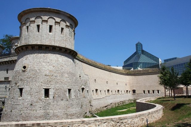
Fort Thüngen, also known as Dräi Eechelen, is a prominent part of Luxembourg's historic fortifications. It stands on a hill, offering a unique view of the Grand Duchy's capital, especially the lower-lying districts of Clausen and Pfaffenthal, and the opposite Corniche.
History+
The fort's origins date back to around 1680, when Vauban built the “Redoute du Parc” here. In 1732, this defensive structure was expanded into a fort by the Austrian fortress commander Baron Adam Sigmund von Thüngen, after whom it was named. It was surrounded by a deep moat and connected to Fort Obergrünewald by a 169-meter-long underground rock passage. The Prussians expanded the fort in 1836 and reinforced it again in 1860. Between 1870 and 1874, it was demolished, with only the three distinctive round towers with their acorn-shaped spires and the foundations, uncovered in 1991, remaining. In the 1990s, the outer walls were completely reconstructed. An initial plan to integrate it into the Museum of Modern Art was prevented by a citizens' initiative. After several years of construction and funding issues, the Luxembourg Fortress Museum finally opened in July 2012.
Location+
Fort Thüngen is located in Luxembourg, in the district of Luxembourg, in the region of Luxembourg, in the country of Luxembourg, at an elevation of approximately 295 m above sea level. It is situated on the slope of Kirchberg in Parc Dräi Eechelen.
On site+
Today, Fort Thüngen is accessible to visitors and houses the Luxembourg Fortress Museum. The three characteristic round towers, which gave the fort its nickname “Three Acorns,” are still preserved.
Nearby+
- Château de Bock (castle), approx. 0.4 km away
- Palais Grand-Ducal (Grand Ducal Palace) (residence), approx. 0.6 km away
- Château de Dommeldange (castle), approx. 2.4 km away
- Château de Septfontaines (castle), approx. 2.6 km away
Take Mobile History with you
You are reading this text for free. Premium adds what matters on the road: descriptions read aloud, sites found through your camera, whole regions taken offline.
- Every description, including the ~17,700 Premium sites
- Audio guide: have descriptions read to you on location
- AR finder: see sites through your camera, with distance and bearing
- Unlimited saved sites
14 days free, then from €2.99 a month. Cancel anytime.
Source: Wikipedia · Licence: CC BY-SA 4.0 · Image: http://en.wikipedia.org/wiki/File:Mudam_04_jnl.jpg
This description draws on the facts documented in the linked Wikipedia article; Wikipedia content is licensed under CC BY-SA 4.0. Wording and editing: Mobile History.
Location: 49.6154, 6.1377