The Fort can be visited
FortressDarien
Fort King George
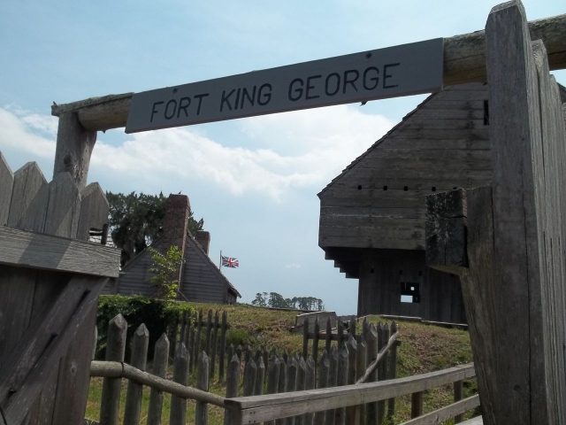
Fort King George, a historic fortress, is located in Darien, McIntosh, Georgia, USA. It was the southernmost British fort in North America and the first on Georgia's coast, strategically situated at the mouth of the Altamaha River.
History+
In the summer of 1719, Carolina colonists requested military protection for the southern border against Spanish, French, and Native American attacks. Consequently, the Carolina administration dispatched Colonel John Barnwell in 1720. He requested British troops for the construction of a border fort on the Altamaha River. An invalid company of about 100 men was sent from London but fell ill during the voyage. Barnwell built the fort with a small group of scouts. By the end of 1721, a blockhouse surrounded by earthworks was completed and named after King George I. In the spring of 1722, the recovered company occupied the fort. By the end of 1722, additional buildings and fortifications were added. Barnwell organized livestock, tools, and seeds to enable self-sufficiency. Spanish Franciscans, who had claimed the area for the Santo Domingo de Talaje mission around 1595, protested against the fortress. A fire in 1725 necessitated reconstruction in 1726. Due to the swampy environment, many soldiers died from diseases, making self-sufficiency impossible. The garrison was withdrawn in 1727. In 1736, Scottish settlers replaced the soldiers, leading to the establishment of present-day Darien. The original site was rediscovered in 1932. In 1940, the state acquired the land, and in 1961, the Georgia Historical Commission took over its administration. From 1988, the fort was reconstructed according to old plans, a process completed in 2004.
Location+
Fort King George is situated approximately 7 meters above sea level in Darien, McIntosh County, Georgia, USA, at the mouth of the Altamaha River.
On site+
Fort King George can be visited today. It comprises a reconstructed triangular fort with earthworks and palisades, a three-story blockhouse, officers' quarters, and a guardhouse. A museum provides information on the history of the fort, the Guale Indians, the Spanish Mission Santo Domingo de Talaje, the Scottish settlers, and the 19th-century sawmills. West of the fort is the cemetery with soldiers' graves, as well as the ruins of three sawmills.
Nearby+
- Fort Frederica (fortress), approx. 15.7 km away
- Fort James Jackson (fortress), approx. 87.4 km away
- Fort Pulaski (fortress), approx. 88.8 km away
- Fort Caroline (fortress), approx. 108.6 km away
Take Mobile History with you
You are reading this text for free. Premium adds what matters on the road: descriptions read aloud, sites found through your camera, whole regions taken offline.
- Every description, including the ~17,700 Premium sites
- Audio guide: have descriptions read to you on location
- AR finder: see sites through your camera, with distance and bearing
- Unlimited saved sites
14 days free, then from €2.99 a month. Cancel anytime.
Source: Wikipedia · Licence: CC BY-SA 4.0
This description draws on the facts documented in the linked Wikipedia article; Wikipedia content is licensed under CC BY-SA 4.0. Wording and editing: Mobile History.
Location: 31.3638, -81.4147