The remains of the Castle can be visited
FortressTraben-Trarbach
Mont Royal Fortress
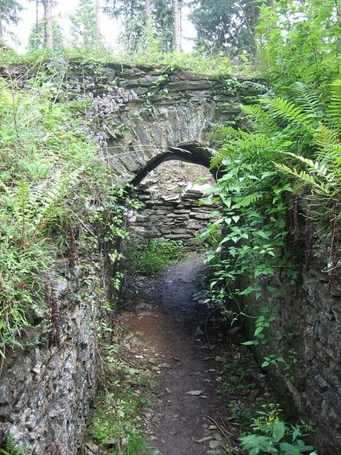
Mont Royal (built between 1687 and 1698) is a fortress ruin north of the town of Traben-Trarbach in the Bernkastel-Wittlich district, Rhineland-Palatinate.
The Mont Royal fortress ruin is located on the Mont Royal mountain ridge of the Moselle river loop near Traben-Trarbach at an altitude of 240 to 305 m and lies approximately 2.7 kilometers north of this small town between the municipality of Kröv in the west and the district of Kövenig on the eastern side.
The Mont Royal fortress was built between 1687 and 1698 according to plans by the fortress builder Sébastien Le Prestre de Vauban, as part of Louis XIV's Reunion Policy, i.e., his annexation policy, serving as a base for further expansion to the east. The complex was constructed by up to 8000 forced laborers with considerable financial expense and covered an area of 50 hectares, with a length of 1600 meters and a width of up to 750 meters. The length of the rampart was 2920 meters with a height of up to 20 meters. The citadel of the fortress was protected by five bastions. A garrison of 8450 soldiers and 3000 cavalry horses was planned. The very large fortress on non-French territory significantly burdened the French state budget.
According to the provisions of the Treaty of Rijswijk of October 30, 1697, demolition began before construction was fully completed.
The fortress remains were partially excavated from 1929 to 1937 with the help of the Reich Labor Service. The political leadership at the time hoped for a propagandistic effect against France through this action. After the Second World War, with increasing tourism, the remains were redeveloped for visitors.
Take Mobile History with you
You are reading this text for free. Premium adds what matters on the road: descriptions read aloud, sites found through your camera, whole regions taken offline.
- Every description, including the ~17,700 Premium sites
- Audio guide: have descriptions read to you on location
- AR finder: see sites through your camera, with distance and bearing
- Unlimited saved sites
14 days free, then from €2.99 a month. Cancel anytime.
Source: Wikipedia · Licence: CC BY-SA 4.0 · Image: http://de.wikipedia.org/wiki/Datei:MontRoyal_Traben.jpg
This description draws on the facts documented in the linked Wikipedia article; Wikipedia content is licensed under CC BY-SA 4.0. Wording and editing: Mobile History.
Location: 49.9736, 7.1147