To be privately owned
FortressKoblenz-Asterstein
Fortress Koblenz-Fort Rheinhell
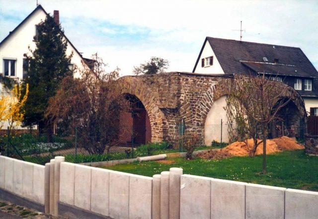
Fort Rheinhell was part of the Prussian Fortress of Koblenz and belonged to the Pfaffendorfer Höhe system. Of the fort, built in the 1860s and razed in the 1920s, only a small remnant of the reduit remains in today's Koblenz district of Asterstein.
Fort Rheinhell was initially developed as an earthwork south of Fort Asterstein after 1859, and then permanently expanded in the form of a lunette from 1864 to 1868. Already in 1864, the facility was connected to the Glockenberg work.
After the First World War, this facility, like the other Koblenz fortress works, had to be de-fortified in execution of Article 180 of the Treaty of Versailles. The ditch walls, ditch defenses, several powder magazines, the hollow traverses, and much more were designated for destruction. The connection to the Glockenberg work was to be breached. The Koblenz De-fortification Office submitted, among other things, a preservation request for the fort's rampart casemate, as it was to continue to be used by a milk cooperative for housing cattle and personnel. After the completed first de-fortification phase (1920-1922), the remaining explosive ammunition was also stored in the fort.
Work on Fort Rheinhell began on April 19 and was reported completed on August 30, 1927. After this, the area remained a military restricted zone for the time being, as it continued to be used by the occupation for training purposes. As with the Arzheimer Schanze, Fort Rheinhell remained heavily devastated after de-fortification. Nothing is known about the fate of the remaining parts of the facility. The area is now built up, a remaining building remnant of the fortress is still used as a garage. In addition, fortress remains repeatedly come to light during excavation work.
Take Mobile History with you
You are reading this text for free. Premium adds what matters on the road: descriptions read aloud, sites found through your camera, whole regions taken offline.
- Every description, including the ~17,700 Premium sites
- Audio guide: have descriptions read to you on location
- AR finder: see sites through your camera, with distance and bearing
- Unlimited saved sites
14 days free, then from €2.99 a month. Cancel anytime.
Source: Wikipedia · Licence: CC BY-SA 4.0 · Image: http://de.wikipedia.org/wiki/Datei:Rheinhell.jpg
This description draws on the facts documented in the linked Wikipedia article; Wikipedia content is licensed under CC BY-SA 4.0. Wording and editing: Mobile History.
Location: 50.3494, 7.6144