The remains of the fortress can be visited
FortressKoblenz-Niederberg
Fortress Koblenz-Fort Rheineck
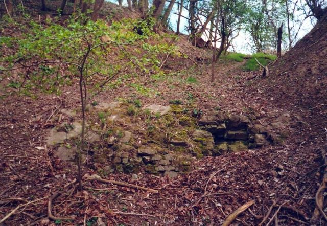
Fort Rheineck (original name Werk Nöllenkopf) was part of the Prussian Fortress of Koblenz and belonged to the Oberehrenbreitstein system. The work, started in 1820, was expanded into a fort by 1880 and razed in 1927. Only a few wall remnants remain of the fort, which was located in today's Niederberg district of Koblenz. It was situated in an advanced line to Ehrenbreitstein Fortress on the mountain of the same name.
The complex originated from a powder magazine laid out in 1820, which was continuously expanded until 1831. After various alterations and extensions in the 1860s and 1870s, the complex, originally named Werk Nöllenkopf, received the name Fort Rheineck in 1880. The fort was connected to Werk Pleitenberg via a connecting line, which was designed for both artillery and infantry.
After the First World War, this complex, like the other Koblenz fortifications, had to be de-fortified in execution of Article 180 of the Treaty of Versailles. Extensive works were planned, such as the removal of the caponiers, various powder magazines, and the breaching of the ditch and rampart. Only the rampart casemate and the hangar were exempt from the destructions. The de-fortification works on the fort began on March 14 and were reported completed on August 30, 1927.
The release of the site by the French occupation army took place together with the Arzheimer Schanze and Werk Pleitenberg on February 11, 1928. There is only sparse information about the fate of the remains. In mid-1933, there was an initiative to level the fortress remains by the Voluntary Labor Service. The workers were to be accommodated in Ehrenbreitstein Fortress during this time. Finally, the company Kettiger Tonwerke acquired a large part of the site and began to remove the remains. However, which works were actually carried out remains unclear. Attentive walkers may still notice wall remnants around the former fortress grounds. Since the area has remained undeveloped overall, various remnants of the work are likely still present underground.
In the 1960s, the area was still used by the Bundeswehr from the neighboring Fritsch Barracks as a tank driving school area and for basic infantry training. Later, a sports field for the barracks was built in the foreground.
Take Mobile History with you
You are reading this text for free. Premium adds what matters on the road: descriptions read aloud, sites found through your camera, whole regions taken offline.
- Every description, including the ~17,700 Premium sites
- Audio guide: have descriptions read to you on location
- AR finder: see sites through your camera, with distance and bearing
- Unlimited saved sites
14 days free, then from €2.99 a month. Cancel anytime.
Source: Wikipedia · Licence: CC BY-SA 4.0 · Image: http://de.wikipedia.org/wiki/Datei:Reste_des_Forts_Rheineck.jpg
This description draws on the facts documented in the linked Wikipedia article; Wikipedia content is licensed under CC BY-SA 4.0. Wording and editing: Mobile History.
Location: 50.3727, 7.6158