The Fortress can be visited
FortressGermersheim
Fortress Germersheim-Weissenburger Tor
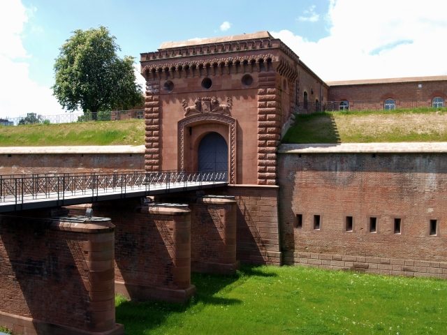
The Germersheim-Weissenburger Tor Fortress is a prominent structure of the former royal Bavarian fortress of Germersheim in Rhineland-Palatinate. As part of a comprehensive defense system in western Germany, it played a crucial role in safeguarding the region against potential attacks from France.
History+
Germersheim's significance as a strategic point was recognized by the German Confederation as early as 1815. Following initial survey work in 1818, the final decision to build the fortress was made in 1832. Construction began on June 30, 1834, with the excavation of the main moat and the laying of the foundation stone on October 18 of the same year. The main construction phase was completed in 1855, but the mine tunnels were not finished until 1861. The fortress, designed not as a federal fortress but as a royal Bavarian installation, provided employment during its construction but later hindered urban development. From 1878, it served as the base for the Royal Bavarian 17th Infantry Regiment “Orff”. After World War I, the fortress was largely demolished between 1920 and 1922 as a result of the Treaty of Versailles, but the surviving parts are now considered important cultural heritage.
Location+
The Weissenburger Tor is located in Germersheim, in the district of Germersheim in Rhineland-Palatinate, Germany, at an elevation of approximately 109 m above sea level.
On site+
The preserved parts of the Germersheim Fortress, including the Weissenburger Tor, can be visited today and offer insights into historical military architecture.
Nearby+
- Germersheim-Fronte Lamotte Fortress (Fortress), approx. 0.2 km away
- Germersheim-Kommandantur Fortress (Fortress), approx. 0.3 km away
- Germersheim-Arresthaus Fortress (Fortress), approx. 0.3 km away
- Germersheim-Seyssel Barracks Fortress (Fortress), approx. 0.4 km away
Take Mobile History with you
You are reading this text for free. Premium adds what matters on the road: descriptions read aloud, sites found through your camera, whole regions taken offline.
- Every description, including the ~17,700 Premium sites
- Audio guide: have descriptions read to you on location
- AR finder: see sites through your camera, with distance and bearing
- Unlimited saved sites
14 days free, then from €2.99 a month. Cancel anytime.
Source: Wikipedia · Licence: CC BY-SA 4.0 · Image: Armin S.
This description draws on the facts documented in the linked Wikipedia article; Wikipedia content is licensed under CC BY-SA 4.0. Wording and editing: Mobile History.
Location: 49.2164, 8.3768