The Castle can be visited
CastleLa Roche-Guyon
Château de La Roche-Guyon
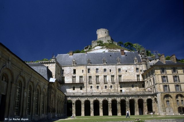
The Château de La Roche-Guyon is the successor building to a medieval castle that was built on a limestone cliff in the bend of the Seine above the town of La Roche-Guyon.
From the 10th century, the castle was part of the border fortifications in the wars against the Normans and at times possessed considerable strategic value. Parts of the complex are dug into the mountain. In the course of the conflicts of the following period, they were further strengthened.
The castle belonged to the Lords of La Roche (French: roche = rock), who traditionally bore the given name Guy and thus gave the place its name. The noble family of La Roche-Guyon descended from Guy de la Roche (early 12th century), existed until the end of the 15th century, and was inherited by the Silly family. They were elevated to the rank of count in 1515 and were inherited by the La Rochefoucauld family, who received the ducal title for La Roche-Guyon in 1622. Their most important representative was the writer François de La Rochefoucauld.
In the 14th century, a manor house was built at the foot of the cliff and a secret passage was dug to the upper castle. In the Renaissance era, its military importance receded into the background. The manor house now served as a hunting lodge, and a vegetable garden was laid out. A wall was intended to protect against the floods of the Seine.
In the 18th century, extensive construction work took place under the Duke of La Rochefoucauld: a representative entrance, terraces, a large salon, a library, and a small theater were built. An observatory was installed in the southeast tower.
In early 1944, the complex once again gained military significance: Army Group B under Field Marshal Erwin Rommel and then Günther von Kluge had their headquarters here until the liberation of the town in August 1944 by the Allies. During the liberation, there was an Allied bombing, causing considerable damage.
Take Mobile History with you
You are reading this text for free. Premium adds what matters on the road: descriptions read aloud, sites found through your camera, whole regions taken offline.
- Every description, including the ~17,700 Premium sites
- Audio guide: have descriptions read to you on location
- AR finder: see sites through your camera, with distance and bearing
- Unlimited saved sites
14 days free, then from €2.99 a month. Cancel anytime.
Source: Wikipedia · Licence: CC BY-SA 4.0 · Image: Hervé Rebours
This description draws on the facts documented in the linked Wikipedia article; Wikipedia content is licensed under CC BY-SA 4.0. Wording and editing: Mobile History.
Location: 49.0812, 1.6279