The remains of the Castle can be visited
CastleManderscheid
Oberburg Castle
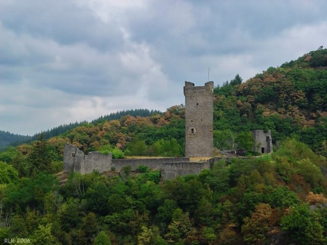
The Oberburg is located on a mountain peak flattened for its construction. It possessed, as can still be seen from the ruins today, an almost triangular outer wall and a five-story keep, which has since been made accessible again. From the keep, one has an excellent view of the Niederburg, the town of Manderscheid, and the beautiful landscape.
The place name Manderscheid is first documented in a deed of gift from Otto II to the Archbishop of Trier from the year 973. This does not, as can be read several times in the literature, coincide with the first mention of the castle. It only becomes historically tangible during the feud between Count Heinrich the Blind of Namur-Luxembourg and Archbishop Albero of Trier, fought over the Abbey of St. Maximin near Trier, between 1141 and 1146. The noble free lords of Manderscheid first appear in 1142 in the witness list of a deed of gift. The place Obermanderscheid gave its name in the 14th century to the Electoral Trier office of Manderscheid, which existed until the end of the 18th century. However, the administrative seat was not in the castle, but in the cellarage of the neighboring town, to which Elector Balduin granted town rights in 1332 (according to other sources, King Ludwig the Bavarian did so as part of a collective privilege). The local possessions of the Elector of Trier virtually represented a bridgehead in the surrounding Luxembourgian territory. In 1673, the castle, still in the possession of Electoral Trier, was finally destroyed by French troops.
Today
The ruins of the Oberburg were fundamentally restored in 1921 by the municipality of Manderscheid, which owns them, and are freely accessible.
Take Mobile History with you
You are reading this text for free. Premium adds what matters on the road: descriptions read aloud, sites found through your camera, whole regions taken offline.
- Every description, including the ~17,700 Premium sites
- Audio guide: have descriptions read to you on location
- AR finder: see sites through your camera, with distance and bearing
- Unlimited saved sites
14 days free, then from €2.99 a month. Cancel anytime.
Source: Wikipedia · Licence: CC BY-SA 4.0 · Image: Rainer Gindele
This description draws on the facts documented in the linked Wikipedia article; Wikipedia content is licensed under CC BY-SA 4.0. Wording and editing: Mobile History.
Location: 50.0941, 6.8173