The remains of the castle can be visited
CastleGrünburg-Leonstein
Leonstein Castle
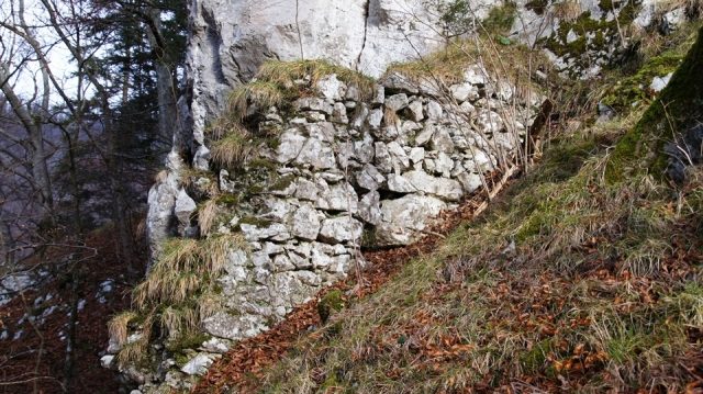
The castle ruin Leonstein is located in the eponymous district of the municipality Grünburg in the Kirchdorf an der Krems district of Upper Austria.
The once existing Leonstein Castle is said to have existed as early as 900 on the local mountain, but it is first mentioned in a document in 1140 as Lewensteine. It was then in the possession of the Bavarian Duke Heinrich and was given as a fief to the ministerialis Perhtoldus de Lewenstaine. The Rohrer family succeeded the Leonsteiners around 1320.
At the end of the 14th century, Leonstein belonged to the brothers Wilhelm and Wolfgang von Rohr. They engaged in a feud with the sovereign Duke Albrecht III. In the course of this dispute, the Rohrer captured an embassy from the Prince-Archbishopric of Salzburg, which was on its way to the Duke, to extort ransom. At the request of the Archbishop of Salzburg, Duke Albrecht then assembled a siege army under the command of Field Captain Zacharias Haderer. After a three-month siege, Haderer was able to occupy the Rabenstein and from there bombard Leonstein Castle with a stone cannon; this is the first use of a firearm in Austria. After three days of bombardment, the castle fell on November 2, 1390. Wilhelm von Rohr was still able to escape through a secret exit.
The conquered castle was destroyed by an explosive fire. The Rohrer only submitted to the sovereign in 1392, and Wolfgang von Rohr sold his share of the destroyed castle to Duke Albrecht. In 1397, Wilhelm von Rohr received permission to build a castle site as a replacement for the destroyed castle. Bernhard von Rohr sold his share of the property in Leonstein to Erhard von Zelking in 1447. In 1459, he also obtained the enfeoffment with the second half from Emperor Friedrich III. He had Leonstein Castle, called "Feichta", built from the castle site and the associated manor farm.
Leonstein Castle Ruin Today+
Behind Leonstein Castle, a path leads up to the castle ruin. Also from the other side behind the Moar's Hengst pasture, a path leads into the forest up to the ruin. Remains of the walls of the destroyed castle are visible on the prominent hill about 0.3 km northwest of the castle. Numerous projectile points, likely dating from the siege of 1390/91, were found on the slope below the castle. Walls, an archway, and a passage are still recognizable from the castle.
Take Mobile History with you
You are reading this text for free. Premium adds what matters on the road: descriptions read aloud, sites found through your camera, whole regions taken offline.
- Every description, including the ~17,700 Premium sites
- Audio guide: have descriptions read to you on location
- AR finder: see sites through your camera, with distance and bearing
- Unlimited saved sites
14 days free, then from €2.99 a month. Cancel anytime.
Source: Wikipedia · Licence: CC BY-SA 4.0 · Image: http://www.wehrbauten.at
This description draws on the facts documented in the linked Wikipedia article; Wikipedia content is licensed under CC BY-SA 4.0. Wording and editing: Mobile History.
Location: 47.9108, 14.2316