The remains of the Castle can be visited
CastleKirkel-Neuhäusel
Kirkel Castle
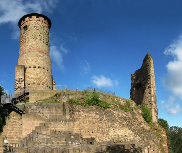
Kirkel Castle is a castle ruin in Saarland, located approximately midway between the cities of St. Ingbert, Homburg, Neunkirchen, and Zweibrücken. It stands on the Schlossberg, a freestanding Buntsandstein rock. Today, the castle ruin is the landmark of the Kirkel-Neuhäusel district of the municipality of Kirkel and a popular excursion destination. The hilltop castle is 307 meters above sea level. The nearest river is the Blies, which flows about 5 kilometers east of the castle through the districts of Limbach and Altstadt, belonging to the same municipality. The Kaiserstraße runs nearby.
In 1075, a Count Gottfried von Kirkel was first mentioned. At the beginning of the 11th century, the castle came into the possession of the Counts of Saarwerden. From 1214 to 1386, the Lords of Kirkel owned the castle as an imperial fief. In the 13th century, the small and round towers were built, and in the 15th century, the village of Kirkel was founded.
Between 1410 and 1689, the castle was owned by the Dukes of Palatinate-Zweibrücken. From 1580 to 1596, Duke Johann I converted the castle into a residential palace. When he was advised against it, as an enemy could shoot into the castle from the higher mountain, he replied: "Then I will shoot even more from within." In 1635, the castle was severely damaged by fire and rebuilt; in 1677, the castle was again destroyed in the Franco-Dutch War. In 1689, it was destroyed again in the War of the Palatine Succession.
From approximately 1740, the ruin was used as a quarry. In 1955, the round tower was rebuilt; it was fitted with a spire. Archaeological excavations in recent years have provided more precise insights into the original appearance of the castle.
Current Use+
Today, the ruin serves as an excursion destination and observation tower. Below the castle, a local history museum, a stone carving workshop, a woodworking shop, a forge, and a sewing room can be found. An archaeological research center has existed since 1994.
Take Mobile History with you
You are reading this text for free. Premium adds what matters on the road: descriptions read aloud, sites found through your camera, whole regions taken offline.
- Every description, including the ~17,700 Premium sites
- Audio guide: have descriptions read to you on location
- AR finder: see sites through your camera, with distance and bearing
- Unlimited saved sites
14 days free, then from €2.99 a month. Cancel anytime.
Source: Wikipedia · Licence: CC BY-SA 4.0 · Image: https://commons.wikimedia.org/wiki/File:BurgKirkel_pano1.jpg
This description draws on the facts documented in the linked Wikipedia article; Wikipedia content is licensed under CC BY-SA 4.0. Wording and editing: Mobile History.
Location: 49.2831, 7.2403