The remains of the Castle can be visited
CastleHardegg - Merkersdorf
Kaja Castle
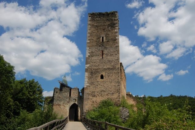
The castle ruin Kaja is located north of the village Merkersdorf, a little off the border river Thaya, on the Kajabach in the Waldviertel, but belongs to the district of Hollabrunn in the Weinviertel. It is located in the Thayatal National Park.
The fortress Kaja was named as the ancestral castle of the Lords of Chiowe. In 1196, Duke Friedrich I sealed numerous documents here before 30 nobles and 24 knights as witnesses. In 1360, Niklas von Kaja sold the castle to Duke Rudolf IV, but already in 1376 it went as a pledge to the Counts of Maidburg-Hardegg. Around this time, Count Burkhard II, the Chancellor of Emperor Karl IV, died at Kaja. At the end of the 14th century, Johann and Heinrich von Leipa conquered the fortress Kaja. They turned their conquest into a robber baron's castle and spread fear and terror in the surrounding villages.
In the years 1425 to 1427, the next conquest followed by the Hussites. A few years later, around 1430, Ulrich von Eyczing (also von Eitzing) received the castle for loyal services and thus appeared for the first time in Lower Austria. However, the chronological sequence of the conquest and surrender of the castle is unclear. The court in Vienna supported Ulrich von Eyczing in the reconstruction of the castle, which was subsequently heavily fortified. At the beginning of the 16th century, the Eyczinger moved their residence to Niederfladnitz Castle, which also belonged to the Kaja dominion. In 1546, Erasmus I, Baron von Eyczing, died at Kaja Castle.
In 1588, Kaja Castle and dominion, as well as the Niederfladnitz dominion, passed to the Trautson family through a daughter of the Eyczinger. In 1781, the family of the Princes Auersperg became owners of the Kaja fortress, and in 1945 the ruin passed to the Counts of Waldstein-Wartenberg.
Surroundings+
Neighboring castles and palaces include Hardegg Castle, Karlslust Castle near Niederfladnitz and Niederfladnitz Castle itself, as well as in the Czech Republic the ruin Neuhäusl (Nový Hrádek) in the Národní park Podyjí.
Take Mobile History with you
You are reading this text for free. Premium adds what matters on the road: descriptions read aloud, sites found through your camera, whole regions taken offline.
- Every description, including the ~17,700 Premium sites
- Audio guide: have descriptions read to you on location
- AR finder: see sites through your camera, with distance and bearing
- Unlimited saved sites
14 days free, then from €2.99 a month. Cancel anytime.
Source: Wikipedia · Licence: CC BY-SA 4.0 · Image: Maciek Wegrzyn
This description draws on the facts documented in the linked Wikipedia article; Wikipedia content is licensed under CC BY-SA 4.0. Wording and editing: Mobile History.
Location: 48.8267, 15.8881