The remains of the castle can be visited
CastleSeeheim-Jugenheim
Jossa Castle
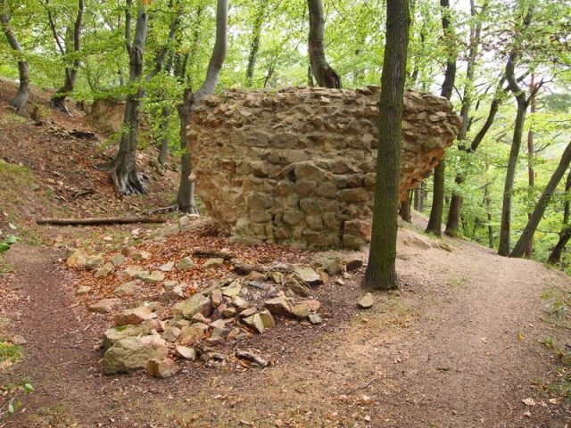
Jossa Castle, also known as Dagsberg, is a ruined hilltop castle, now only existing in remnants, located at 290 m above sea level between Jugenheim and Alsbach in the Darmstadt-Dieburg district.
The castle was built around 1290-1300 by the brothers Gebhard II and Giso IV von Jossa on the Dagsberg. They were the sons of Reinhard I von Jossa (named after Jossa Castle in Burgjoß near Salmünster) and his wife Agnes, a daughter of the noble lord Konrad II von Bickenbach (1245-1270) and his wife Guda von Falckenstein (1237-1287), the widow of Schenk Konrad II von Klingenberg. After the death of Konrad (before 1272) and Guda (before 1290), Agnes and her sons Gebhard and Giso inherited the Jossa district, which consisted of Jugenheim, Balkhausen, Quaddelbach, Winthan, Staffel, and the exclaves Langwaden and the Dietersklingen estate. On the approximately 295 m high castle hill near Jugenheim, then called Dagsberg, the brothers built the castle, which was then named Jossa.
Soon thereafter, on August 4, 1312, Gerhard and Giso enfeoffed the castle to the Archbishop of Mainz, Peter von Aspelt, and received it back from him as a fief, with the obligation to keep it open for the Archbishop. In feuds, Giso was to remain neutral and Gerhard was to provide assistance to the Mainz forces.
Gerhard II died around 1335, and his heirs gradually sold the castle and the associated lands to the Schenken von Erbach. Likewise, Giso's widow Hedwig and her son sold their shares to Erbach. Thus, the entire Jossa district, although still a Mainz fief, came into the sole possession of the Erbach family. After 1360, the castle fell into disrepair and was gradually dismantled over time for material.
Excavation and Later Use+
In September 1848, Grand Duke Ludwig III of Hesse-Darmstadt had excavations carried out in the ruin, but not much was found: three storage pots, a horn, a small shield, nails, and a small sword. In 1860, the foundations uncovered in 1848 were backfilled. The mounded hill was leveled and developed into a dance floor. Today, hiking trails lead past the remains of the rampart and the moat.
Features of the Former Castle+
The castle was secured with a double rampart system towards the slope. The rampart system is still preserved. On a footprint of 25 m x 40 m, there was a residential building and an economic building in the west of the complex, and a stable and the keep, which had a diameter of 8.4 m, in the east. The shield wall was up to 3.75 m thick. There was apparently neither a well nor a cistern, and this lack probably explains the early abandonment of the complex. The castle had no zwinger, but within the ring wall, there was another wall that extended from the keep into the courtyard, so that enemies could be held back until the defenders had retreated into the tower.
Take Mobile History with you
You are reading this text for free. Premium adds what matters on the road: descriptions read aloud, sites found through your camera, whole regions taken offline.
- Every description, including the ~17,700 Premium sites
- Audio guide: have descriptions read to you on location
- AR finder: see sites through your camera, with distance and bearing
- Unlimited saved sites
14 days free, then from €2.99 a month. Cancel anytime.
Source: Wikipedia · Licence: CC BY-SA 4.0 · Image: http://www.wehrbauten.de/thread.php?threadid=971
This description draws on the facts documented in the linked Wikipedia article; Wikipedia content is licensed under CC BY-SA 4.0. Wording and editing: Mobile History.
Location: 49.7441, 8.6379