To be privately owned
CastleSchwäbisch Gmünd - Rechberg
Hohenrechberg Castle
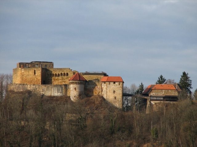
The Hohenrechberg, also written Hohen-Rechberg, is the ruin of a medieval spur castle south of Schwäbisch Gmünd, near the Rechberg district (Am Burgwall 24) in the Ostalbkreis in Baden-Württemberg.
The castle ruin is located at 644.2 m above sea level on the western shoulder of the Rechberg. The Rechberg is a mesa and belongs to the Three Kaiserberge. Geographically, it is located on the northern edge of the Swabian Alb.
A Ulrich von Rechberg is first mentioned in 1179. He is presumably the builder of the castle, which was built between 1200 and 1250. It is first mentioned in 1355. Built as a Staufer ministerialis castle, Hohenrechberg Castle was the ancestral seat of the later Counts of Rechberg. It formed the historical and administrative center of their dominion.
From 1448 to 1450, soldiers from the imperial cities of Schwäbisch Gmünd and Schwäbisch Hall plundered the area around the castle, but did not dare to attack it. In the German Peasants' War of 1525, Hohenrechberg was spared by the plundering peasants. However, the castle inhabitants could not prevent the monasteries of Lorch and Adelberg and the nearby Hohenstaufen Castle from being burned down. In 1546, the Schmalkaldic League marched before the castle, but it remained unharmed. In contrast, Schwäbisch Gmünd was captured.
The castle was rebuilt and expanded several times. Until 1585, the dominion ruled directly from its ancestral castle. Both in 1648 during the Thirty Years' War and in 1796 during the French Revolutionary Wars, the castle was occupied by the French, but never destroyed. In 1865, the castle became a ruin due to a fire caused by lightning.
Until 1986, the castle was owned by the noble family. At that time, it was sold to a private individual from Göppingen.
Description+
The irregularly polygonal castle complex features a curtain wall with bossed ashlar, a Staufer palas next to the rectangular projecting gatehouse, and a 30-meter-deep castle well. Since 1806, the castle chapel, "Alte Kapelle" (Old Chapel), has no longer been used.
Take Mobile History with you
You are reading this text for free. Premium adds what matters on the road: descriptions read aloud, sites found through your camera, whole regions taken offline.
- Every description, including the ~17,700 Premium sites
- Audio guide: have descriptions read to you on location
- AR finder: see sites through your camera, with distance and bearing
- Unlimited saved sites
14 days free, then from €2.99 a month. Cancel anytime.
Source: Wikipedia · Licence: CC BY-SA 4.0 · Image: Peter Schneider
This description draws on the facts documented in the linked Wikipedia article; Wikipedia content is licensed under CC BY-SA 4.0. Wording and editing: Mobile History.
Location: 48.7557, 9.7819