The remains of the castle can be visited
CastleBuhla
Hasenburg Castle
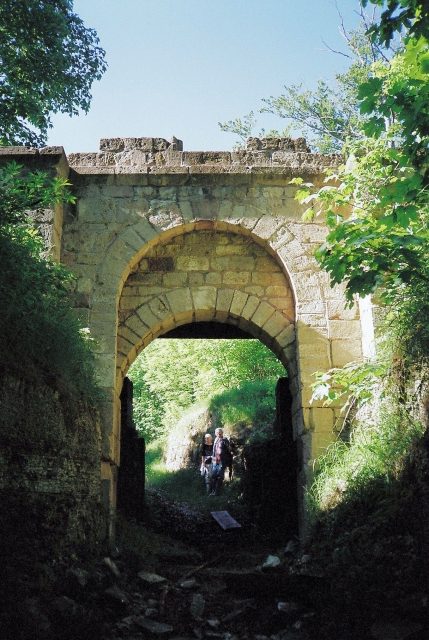
The Hasenburg, also known as Asenberg or Asenburg, was an important imperial castle in the area of the villages of Buhla, Haynrode and Neustadt in the Eichsfeld district in Thuringia.
The hilltop castle is located on an isolated mountain peak on the northern edge of the Bleicheröder Mountains, about 10 km (as the crow flies) northeast of Worbis. From the summit of the mountain, which rises about 160 m above the valley floor, important roads connecting the southern edge of the Harz with the Mühlhausen Basin were to be monitored.
The roughly triangular mountain plateau is identified as a fortress by high medieval fortifications of Emperor Henry IV's imperial castle. The complex, conceived at this exposed location, was already naturally secured by steep slopes; in addition, a system of ramparts and ditches was created, with the only access from the south. A chamber gate measuring 6x2 m was uncovered in the access area. The imperial castle concentrated on the southern part of the mountain, while the adjoining northern area, also enclosed by fortifications, was occupied by residential and supply buildings (some already with stone foundations), which can also be considered part of the castle. Dating: The excavated findings were interpreted as the castle mentioned in connection with the Saxon War. The Hasenburg has contributed much to the understanding of high medieval fortress construction.
Archaeological research of the Hasenburg began as early as the 1960s. In the course of the excavations, numerous finds were recovered, which also identify the site as a continuously settled and already fortified hilltop settlement of the Hallstatt period, which was repeatedly claimed by subsequent settlers. The peripheral areas in the valley and the slopes of the castle also showed numerous find sites. The tradition of a pagan sanctuary or cult site on the Götterberg, already widespread in the late Middle Ages, also suggested this. Köhler suspects the emergence of numerous hilltop settlements as a result of internal conflicts between neighbors, rather than as an indication of warlike conflict between neighboring peoples.
From the 7th century, the Franks occupied the mountain and used it as a border fortress against the Saxons. The high medieval finds confirm the battles of King Henry IV with the rebellious Thuringians and Saxons mentioned in the chronicle of Lambert of Hersfeld. The Hasenburg served as a building block in a system of fortifications to secure the crown property around the Harz and to strengthen central power. The time of the castle's destruction can be narrowed down to the year 1074 based on the findings.
After the destruction of the castle by a large fire (the majority of the buildings consisted of wood and half-timbering), the castle was still occupied until the 13th century, which indicates a partial reconstruction. Even in later times, the inhabitants still used the place as a refuge during raids.
Current Use+
The castle site is a protected archaeological monument. The relevant area is used for agriculture and forestry and is freely accessible to visitors.
Take Mobile History with you
You are reading this text for free. Premium adds what matters on the road: descriptions read aloud, sites found through your camera, whole regions taken offline.
- Every description, including the ~17,700 Premium sites
- Audio guide: have descriptions read to you on location
- AR finder: see sites through your camera, with distance and bearing
- Unlimited saved sites
14 days free, then from €2.99 a month. Cancel anytime.
Source: Wikipedia · Licence: CC BY-SA 4.0 · Image: http://commons.wikimedia.org/wiki/File:Hasenburg,_Burgtor_%282000%29.JPG
This description draws on the facts documented in the linked Wikipedia article; Wikipedia content is licensed under CC BY-SA 4.0. Wording and editing: Mobile History.
Location: 51.4490, 10.4872