The remains of the castle can be visited
CastleHösbach-Rottenberg
Gräfenberg Castle
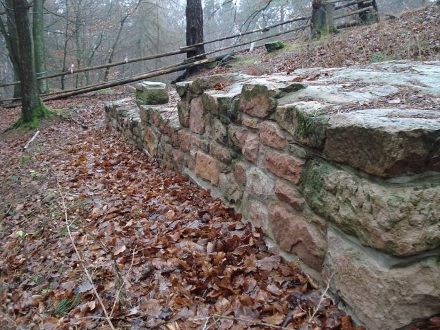
The Gräfenberg is a 363.6 m high mountain in the Bavarian Spessart. It is located in the district of Aschaffenburg south of Rottenberg. It is a sandstone outlier surrounded by limestone. This is quarried in a valley in Rottenberg. On the summit of the Gräfenberg, there was once a castle complex belonging to the Counts of Rieneck. Until after the Second World War, sandstone was quarried there. The southwestern slopes are used for viticulture.
Summit+
The summit of the Gräfenberg was used in various eras. This was confirmed by an excavation in autumn 2007.
Neolithic Age
In the Neolithic Age, the summit was used as a hunting ground and for wood extraction. This was proven by finds of arrowheads. However, a Neolithic settlement can be ruled out.
Early Middle Ages
In the Early Middle Ages, there was a ditch and rampart system on the Gräfenberg with a fortified, at least temporarily inhabited settlement. Early medieval ceramic remains were found during the excavation.
Middle Ages
The castle, built shortly before 1260, had a massive ring wall that surrounded the entire complex, thus providing protection to the inhabitants. The approximately two-meter-thick and presumably over ten-meter-high wall was integrated into the early medieval ring wall. It had a wooden battlement with a tiled roof. The buildings in the castle courtyard were made of stone and wood. From the then unwooded summit, the Aschaff valley could be overlooked. The castle was razed and abandoned only a few years after its construction.
Through quarrying work in the mid-19th century, the last remains of a round tower and the entrance gate, as well as about 80% of the ruin, were destroyed. Some of the wall stones were reused for the construction of houses and the church in Rottenberg. Around 1900, quarry workers are said to have found a stone tablet with an inscription and a coat of arms. This was supposedly reburied by a landslide. According to the workers, the tablet bore the coat of arms of the Counts of Rieneck. A recovery of the stone tablet was not financed due to the implausibility of the story. During the excavations in 2007, no such stone tablet could be found. It is assumed that the tablet actually existed, but was dismantled and sold after its discovery.
During the excavations, entire sections of the wall, roof tiles, as well as stairs and gates were uncovered, allowing the Counts of Rieneck to be identified as the builders of the castle. It can be assumed with a high degree of probability that the ruins on the Gräfenberg are the remains of "Burg Landesehre" mentioned in connection with the Rieneck castle building ban.
Legend+
According to legend, the Lords of Griefenberg lived on the Gräfenberg. On the opposite Klosterberg, there was a castle complex belonging to the allied Knights Templar. There was a protective alliance between the inhabitants of the two mountains. The ringing of a bell was supposed to ensure mutual help in case of danger. On a stormy night, the Klosterburg was attacked. They rang the bell to call the Griefenberg counts for help. This was in vain, however, as it was the Griefenbergers themselves who ambushed the Templars and killed them all. Thereupon, Archbishop Peter von Aspelt had the Griefenbergers' castle destroyed and their lords executed. Since then, on dark nights, three sinister figures, disguised as robbers, with large floppy hats, are said to have been sighted from time to time on the summit of the Gräfenberg.
Take Mobile History with you
You are reading this text for free. Premium adds what matters on the road: descriptions read aloud, sites found through your camera, whole regions taken offline.
- Every description, including the ~17,700 Premium sites
- Audio guide: have descriptions read to you on location
- AR finder: see sites through your camera, with distance and bearing
- Unlimited saved sites
14 days free, then from €2.99 a month. Cancel anytime.
Source: Wikipedia · Licence: CC BY-SA 4.0 · Image: http://de.wikipedia.org/wiki/Datei:Gr%C3%A4fenberg_Mauer.JPG
This description draws on the facts documented in the linked Wikipedia article; Wikipedia content is licensed under CC BY-SA 4.0. Wording and editing: Mobile History.
Location: 50.0324, 9.2306