The remains of the Castle can be visited
CastleMüstair
Balcun At Castle
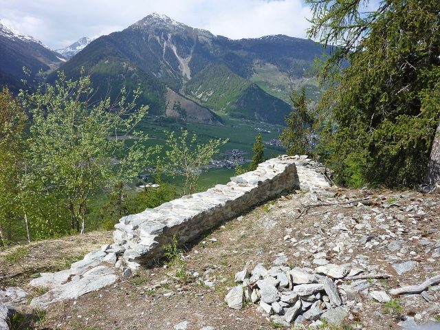
The ruin of the former castle of Balcun At is located in the municipality of Müstair in the lower Münstertal in the Swiss canton of Graubünden. The sparse remains of walls lie 230 meters above the valley floor to the east of the village on the spur of a steep ridge on the southern edge of the Val Brüna.
Name+
The name Hohenbalken appears twice in the canton of Graubünden. The first mention of the name dates from 1427: ...I Janutt Carl de Balkun ault or called von Hohenbalken in German... Obviously, the name comes from a high (Latin: altus) balcony or gallery. Later, the name Balkun ault was Germanized to Hohenbalken; the balcony became a beam (Balken). Whether a transfer of the name from the Münstertal to Hohenbalken Castle in Surselva took place is conceivable but not clarified.
Layout+
Balcun At Plan.jpg The layout of the hilltop castle with a tower of Balcun At corresponded in its type to numerous castles in Graubünden and South Tyrol. It was built in one go and reached a considerable size with a maximum diagonal of the core building of 41 meters.
On the highest point of a rocky outcrop, remains of an almost square tower have been preserved; its dimensions were about 10 meters with a wall thickness of 1.2 to just under 1.50 meters. Apart from a wall section barely two square meters in size, the walls have collapsed. Uphill, the tower was secured by an artificially created neck ditch, which is now filled with rubble.
West of the tower, a 20-meter long section of a wall has been preserved, which followed the steeply sloping plateau edge and enclosed the complex on the valley side. At its northern and southern ends, the wall branched off uphill. The southern branch of the wall is still partially recognizable in places, sinking into the forest floor near the tower; the northern one has collapsed. Whether these are the remains of a curtain wall or a building cannot be determined without excavations. The interior of the complex shows no traces of construction but is filled with considerable amounts of rubble.
Access to the complex was from the west via a rock band into the rocky southern flank. The castle path is still partially recognizable. South of the path are flat rock plateaus where one can imagine small outbuildings.
In September 2000, on the initiative of the Graubünden Castle Association, with the help of the municipality of Müstair and the Berufswahlschule Bülach, endangered wall remains were uncovered and secured.
There is no information about the origin of the castle. The layered masonry and hints of opus spicatum allow a dating to the 12th or 13th century. Small finds that would allow a more precise dating did not come to light.
A complex of this size directly above the episcopal monastery of Müstair could not have been built without consent. It is conceivable that servants of the bishop built the castle. A connection of the builders with the family of Hohenbalken cannot be ruled out, as their representatives repeatedly appear as servants of the bishop.
Destruction+
When and how the castle was destroyed is also unknown. Traces of charcoal near the tower and on the west wall indicate a fire. A collapse on the unstable and rugged building ground is also conceivable. According to other reports, it is said to have been destroyed by Rudolf von Planta during the Bündner Wirren.
Take Mobile History with you
You are reading this text for free. Premium adds what matters on the road: descriptions read aloud, sites found through your camera, whole regions taken offline.
- Every description, including the ~17,700 Premium sites
- Audio guide: have descriptions read to you on location
- AR finder: see sites through your camera, with distance and bearing
- Unlimited saved sites
14 days free, then from €2.99 a month. Cancel anytime.
Source: Wikipedia · Licence: CC BY-SA 4.0 · Image: http://de.wikipedia.org/wiki/Datei:Balcun_At_Nordecke.jpg
This description draws on the facts documented in the linked Wikipedia article; Wikipedia content is licensed under CC BY-SA 4.0. Wording and editing: Mobile History.
Location: 46.6250, 10.4605