To be privately owned
CastleHof am Regen
Hof Castle
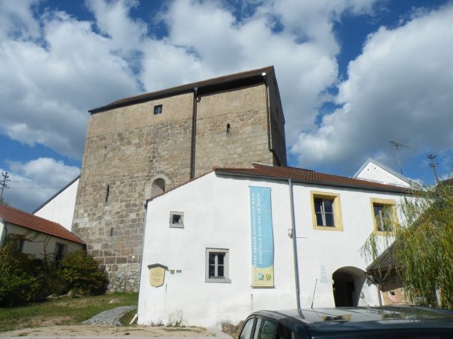
The ruin of Hof am Regen Castle is a sight to behold in the village of Hof am Fluss Regen, which belongs to the town of Nittenau in the Upper Palatinate administrative district (Bavaria). There and in the two neighboring castles, Stefling Castle and Stockenfels Castle Ruin, the so-called Ghost Hike is held annually.
Hof am Regen Castle had the status of a closed Hofmark, whose owners possessed lower jurisdiction. Nevertheless, the noble seat played an important role, as it was home to a respected noble family, the Hofer, who gradually spread to other castles in the area. The Hofer family is first mentioned in a document around 1150 as a ministerial family of the Wittelsbachs.
By the middle of the 13th century, the Hofer had achieved important positions in political life. The year 1340 was a decisive year for the Hofer. There was a family dispute at that time, which led to the split of the "Hofer zu Hof" and the "Hofer zu Lobenstein".
In the 15th century, one branch called itself "Hofer zu Sünching". Other members of the noble family resided at the castles of Sengersberg, Drachenstein, Hirschling, and Triftling.
In 1340, Otto and Dietrich der Hofer retreated to Lobenstein Castle. Both were vassals of the Palatinate princes. Wigeleus was followed by Hiltprand von Hof, who is mentioned in a document in 1481 and appears in the oldest Landsassenmatrikel in 1488. This marks the end of this lineage.
New owners of the castle and the Hofmark from 1735 were the Counts of Thürheim. In 1735, the castle and Hofmark passed to the Lords of Fischbach. Both properties went to Lieutenant General Wilhelm Karl Graf von Eckart in 1801.
Castle Complex+
The castle complex consists of a southern outer bailey and the main castle in the north, which essentially comprises a Romanesque country church from the 12th century, later extended with two secular upper floors for residential and utility purposes, thus expanding it into a tower castle. Frescoes from the second half of the 15th century can be found in the apse of the now restored chapel. The wall thickness of up to 2.50 meters and several loopholes bear witness to the defensiveness of the entire complex.
Take Mobile History with you
You are reading this text for free. Premium adds what matters on the road: descriptions read aloud, sites found through your camera, whole regions taken offline.
- Every description, including the ~17,700 Premium sites
- Audio guide: have descriptions read to you on location
- AR finder: see sites through your camera, with distance and bearing
- Unlimited saved sites
14 days free, then from €2.99 a month. Cancel anytime.
Source: Wikipedia · Licence: CC BY-SA 4.0
This description draws on the facts documented in the linked Wikipedia article; Wikipedia content is licensed under CC BY-SA 4.0. Wording and editing: Mobile History.
Location: 49.2071, 12.2166