The ancient town can be visited
Ancient BuildingYotvata (יטבתה)
Ancient Town Costia (Yotvata, יטבתה)
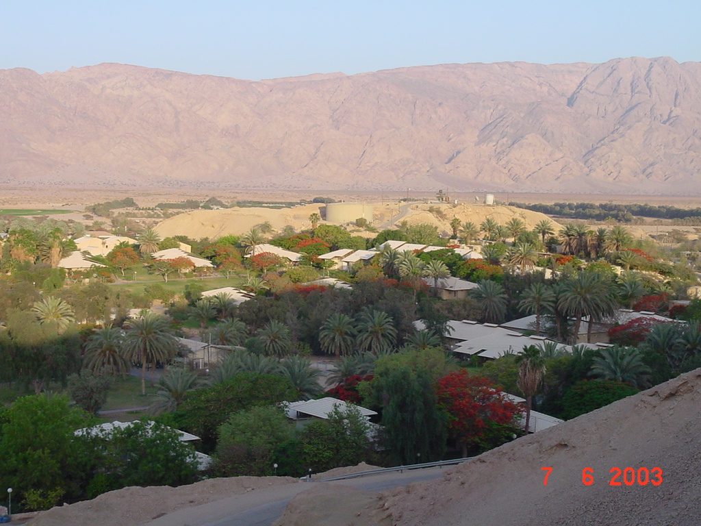
In the Israeli Arava Valley, not far from the Jordanian border, lies the ancient city of Costia. This archaeological site, also known as Yotvata, bears witness to a long history of settlement, favored by an excellent water supply and dating back to the Iron Age.
History+
Between 2003 and 2007, excavations led by Gwyn Davies and Jodi Magness brought significant finds to light. Near the springs, archaeologists discovered the remains of a two-story stone building, whose ceramic finds indicate use from the 2nd century BCE to the 2nd century CE, including Hellenistic, Nabataean, and early Roman shards. An earthquake at the beginning of the 2nd century destroyed this structure. Approximately 500 meters away, a 30 by 35 meter Nabataean building was identified, possibly corresponding to the Temple Ad Dianem recorded on the Tabula Peutingeriana. One kilometer southwest of the kibbutz, a late Roman castellum was excavated, built around 300 CE, square in shape, with a watchtower at each corner, and featuring a large bath. After destruction by fire, the castellum experienced three more construction phases before being abandoned around 370-380. In the 5th century, the Byzantines reused the complex, followed by an early Islamic settlement phase in the late 6th or early 7th century. In 1958, the architectural remains were significantly damaged by the construction of an oil pipeline.
Location+
The ancient city of Costia is located in Yotvata in the Southern District of the Southern Region in Israel, at an elevation of approximately 62 meters above sea level.
On site+
The ancient city of Costia is now accessible to visitors and can be explored.
Nearby+
- Montreal Castle (Castle), approx. 87.1 km away
- Ancient City of Avdat (Ancient Buildings), approx. 104.3 km away
- Hatzeva Fortress (Fortress), approx. 104.3 km away
- Ancient City of Nitzana (Ancient Buildings), approx. 124.9 km away
Take Mobile History with you
You are reading this text for free. Premium adds what matters on the road: descriptions read aloud, sites found through your camera, whole regions taken offline.
- Every description, including the ~17,700 Premium sites
- Audio guide: have descriptions read to you on location
- AR finder: see sites through your camera, with distance and bearing
- Unlimited saved sites
14 days free, then from €2.99 a month. Cancel anytime.
Source: Wikipedia · Licence: CC BY-SA 4.0 · Image: Gordio / CC BY-SA 3.0 via Wikimedia Commons
This description draws on the facts documented in the linked Wikipedia article; Wikipedia content is licensed under CC BY-SA 4.0. Wording and editing: Mobile History.
Location: 29.8839, 35.0476