The ancient archaeological site can be visited
Ancient BuildingMadara (Мадара)
Ancient archaeological site Madara (Мадара)
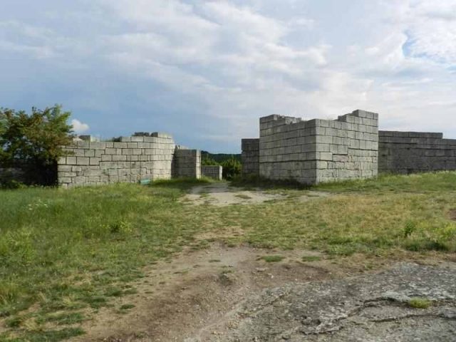
The ancient archaeological site of Madara, located in the Shumen region of Bulgaria, is a fascinating testament to human settlement over millennia. Known for its majestic cliffs and rich history, it harbors traces of various cultures that made this place a significant center.
History+
The settlement of Madara began in the Neolithic period and continued over the centuries, attracted by the cliffs and good water supply. Cave temples, castles, and monastic complexes were built here. Archaeological finds confirm the presence of Thracians, Romans, Byzantines, Slavs, and Bulgarians. In the 20th century, initial traces of Thracian and Greek trade relations were discovered during excavations in burial mounds. Madara experienced strong Roman influence, evidenced by a Villa Rustica from the 2nd to 4th centuries. In the 4th century, a fortress was built on the plateau, which was used until the Ottoman conquest in the 14th century. Madara also played an important role in the Middle Ages, particularly due to its proximity to the Bulgarian capitals Pliska and Preslav. In the 14th century, a large rock monastery with over 150 caves was established here. After the Ottoman conquest, Madara lost its significance, and many structures were destroyed, with the exception of the famous Madara Rider relief.
Location+
The ancient archaeological site of Madara is located in the village of Madara, in the district of Shumen in the Shumen region, Bulgaria, at an elevation of approx. 368 m above sea level.
On site+
Visitors can explore the ancient archaeological site today. An archaeological museum, opened in 1935, showcases over 350 original artifacts from the Madara region, illustrating the settlement's history across different eras.
Nearby+
- Ancient City of Pliska (Ancient Structures), approx. 12.4 km away
- Basilica of Pliska (Sacred Building), approx. 13.7 km away
- Shumen Fortress (Fortress), approx. 18.4 km away
- Preslav Fortress (Fortress), approx. 28.9 km away
Take Mobile History with you
You are reading this text for free. Premium adds what matters on the road: descriptions read aloud, sites found through your camera, whole regions taken offline.
- Every description, including the ~17,700 Premium sites
- Audio guide: have descriptions read to you on location
- AR finder: see sites through your camera, with distance and bearing
- Unlimited saved sites
14 days free, then from €2.99 a month. Cancel anytime.
Source: Wikipedia · Licence: CC BY-SA 4.0 · Image: http://www.wehrbauten.de
This description draws on the facts documented in the linked Wikipedia article; Wikipedia content is licensed under CC BY-SA 4.0. Wording and editing: Mobile History.
Location: 43.2763, 27.1203